To Misión Santa Maria de los Angeles
In May of 2007, Elizabeth and I (in a 2005 Toyota Tacoma) made the trip to the last mission founded by the Jesuits. Joining us (in a Land Rover LR3) was Roy and Blanche. Both Roy and I have been to the mission before, but it was our ladies’ first trip over one of the toughest roads in Baja.
The road to the mission ruins begins at Rancho Santa Ynez (Ines), 300 miles south of the border on Highway One. The road was constructed by the ranch over many years to reach the mission and continue on to the Sea of Cortez where the ranch also owned property at Gonzaga Bay’s Punta Final.
Construction of this ranch-built road ended about 2 miles past the mission about when the new Transpeninsular Highway (Mexico #1) was completed (in December of 1973) offering faster (although longer) access to Gonzaga Bay.
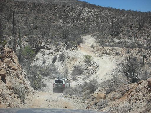
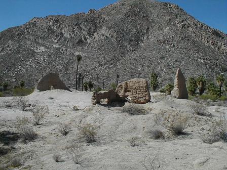
The road to the mission is very steep and rocky and should only be attempted with high clearance, four wheel drive rigs. The biggest challenge is a steep grade I named the ‘Widowmaker’. It caused travel partner ‘Baja Mur’ and I to be tossed to the ground with injuries while attempting to ride up it on a quad and motorcycle. Photos of that 1999 trip and my 2003 trip in my truck are linked at the end of this page.
GPS waypoints are set to map datum WGS 84.
Rancho Santa Ynez

Blanche and Elizabeth chat with ranch managers Matilda ad Oscar. Good tacos and cold drinks can be ordered here before the mission voyage begins.
Santa Ynez (Santa Inés) is a mile south of Cataviña and a mile off the highway. Here find meals, rooms, and camping.
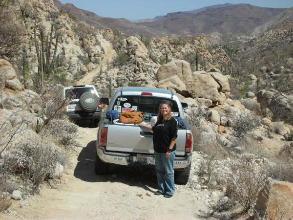
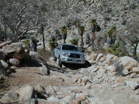
1.8 miles from the ranch is this large gully crossing. Climbing up the opposite side will be the first challenge to your four wheel drive.
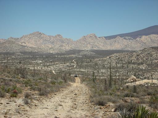
A long straight, but rough stretch of road follows that gully crossing.
Peninsular Divide (elev. 2,512′)
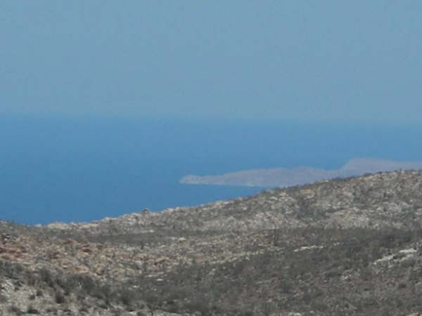
9.9 miles from the ranch is the high elevation point of the drive. Punta Final and the Sea of Cortez come into view.
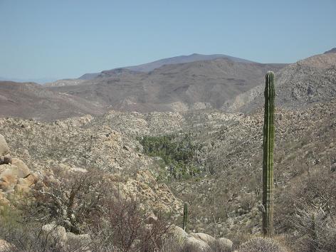
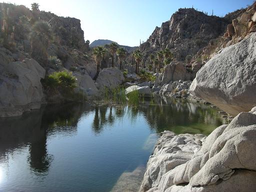
An oasis in the canyon ahead is reached after several steep down-grades.
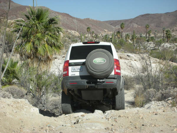
The road makes a steep drop here. We stop and check it before going over the edge. Notice the angle of the Land Rover as Roy drives down it.
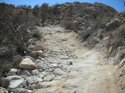
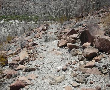
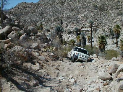
Much of the roadbed is rocks!
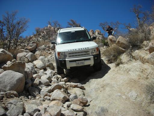
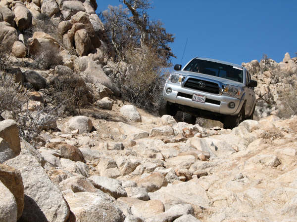
The ‘Widowmaker’
13.3 miles from the ranch is the top of the steep downgrade, I call ‘The Widowmaker’. Many park here and walk the last 1.1 miles to the mission (fearing they won’t be able to drive back up)!
Roy and Blanche are the first ones down, as Elizabeth and I watch.
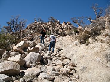
Roy took this photo of Elizabeth helping me climb back up, so we could take our turn driving down!
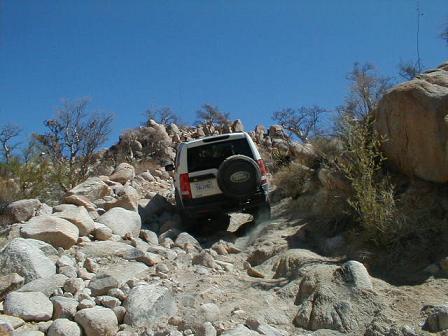
The Toyota heads down over the sharp rocks…
Tire placement is key when driving over boulders!
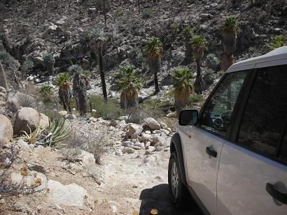
Usually a wet bog here:
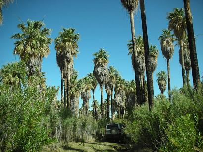
Pass through this oasis for a few hundred feet before climbing over a rocky hill to the mission valley. In the past, this part of the road was under water!
Nearing the mission is more steep, rough road. Going down all these grades is tough, but the real challenge is climbing back up them all when you want to leave!
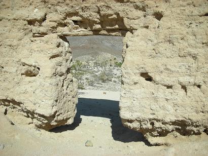
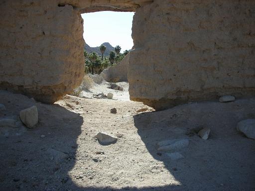
Mission ahead!!!
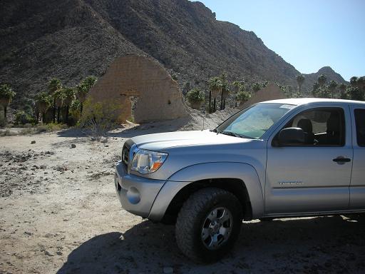
After (less than a mile) of very bad road from the oasis, Santa Maria comes into view.
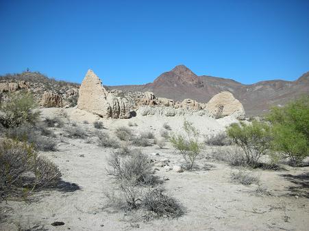
Mission Santa Maria 29°43.90′, -114°32.84′, elev. 1,628′
14.4 miles (and 3 1/2 hours) from Rancho Santa Ynez… we made it!
I was very excited to bring Elizabeth here for both the scenic beauty and the challenging road in.
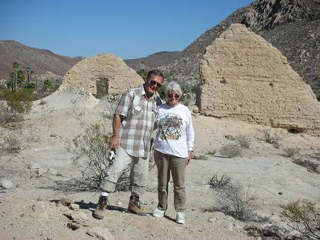
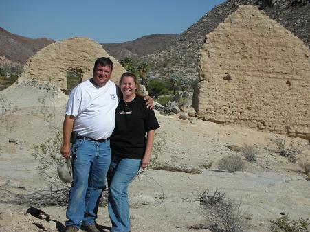
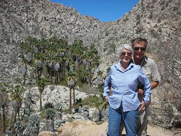
Roy and Blanche at Mission Santa María…
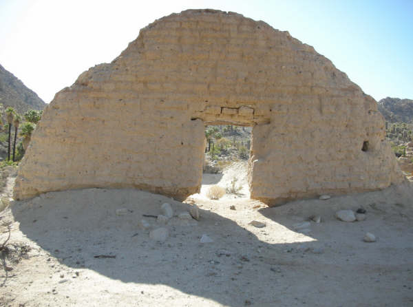
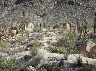
The only other adobe ruins were these rooms that sheltered the padre and stored supplies.
Misión Santa María de los Angeles 1767-1775
This site was picked by the Jesuits after the first location (at Calamajué) failed due to bad water. Santa María would be the final Jesuit mission established in the New World!
In February of the following year (1768), the Jesuits were removed from (Baja) California after Spain’s King Carlos III believed they were not sharing the rumored ‘riches of the land’. The replacement Franciscan padres arrived here in May, 1768 and constructed the adobe that we see remains of, 239 years later.
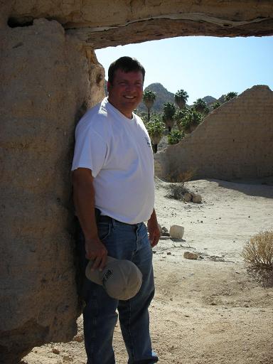
Santa María is one of my favorite places to visit in Baja California…
The doorway base is eroding under the walls from any rainfall that exits here. We hope INAH will repair this and install drainage before the wall falls.
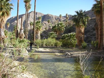
About a mile past the mission, the road reaches the sandy arroyo. Up the arroyo (left turn), Roy showed us this oasis where we made camp.
0.3 mile on down the arroyo (1.3 from the mission) is a road left out of the arroyo and on to the ‘bulldozed grade’ where construction towards Punta Final ended. This road to the left is easily missed and tracks do continue ahead in the arroyo, only to end at rocks and palms.
Photos at the top of the bulldozed grade in my 2003 trip web page.
Beautiful!!!
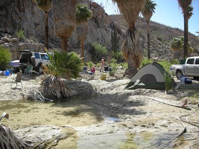
Our oasis camp site.
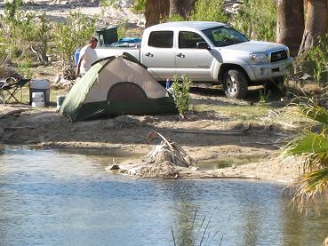
Not bad for the middle of the Baja desert!
We stayed here two nights, it was perfect!
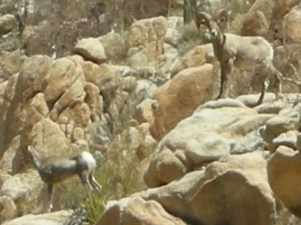
BORREGOS!!!
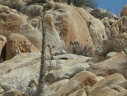
Our first morning there, a family of bighorn sheep visited us! This was the cliff right above our camp and Elizabeth was facing it as we were sitting around after breakfast.
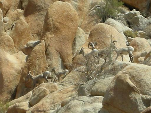
They were totally silent. If Elizabeth hadn’t seen them we would have missed this great experience.
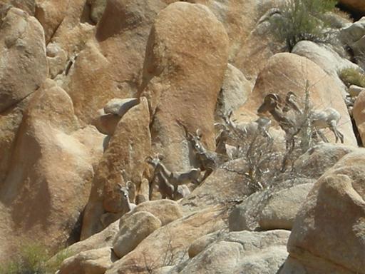
They were coming out of the hills to get to the water.
The ‘alpha male’ made sure we stayed in our camp before they all went for a drink.
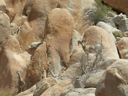
Close Up
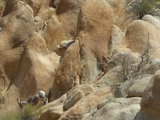
They drank behind boulders, out of view, then returned up the cliffside and were gone.
The Royal Road or ‘King’s Highway’
‘El Camino Real’ heading north from Mission San Borja to Mission Santa María switchbacks down the mountain to Arroyo Santa María (seen in background). It was difficult to find until I started climbing straight up from the auto road where I was told it came down the mountain.
El Camino Real 29°43.13′, -114°31.80′ elev. 1,413′
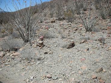
I mark the mission trail with rocks where it meets the auto road, 1.5 miles from the mission, on the way to the ‘bulldozed grade’.
Beyond this point in the photo, the auto road gets very bad and requires a hike to the ridge top to see the canyon and petroglyphs (see my 2003 trip page for details). That is where the ranch’s road building attempt ended.
Day 3, heading out

We stop back at the mission to rest before attempting to climb up the ‘Widowmaker’ and get back to civilization!
Looking south:
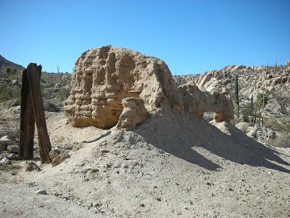
The padre’s rooms, and main church ruins in the background.
46 years ago…
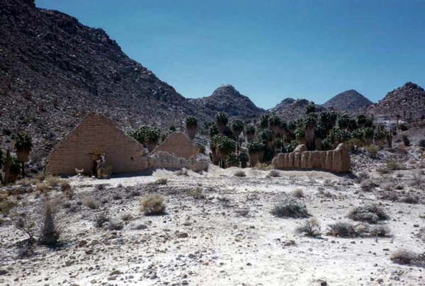
Photo taken by Howard Gulick in April, 1961.
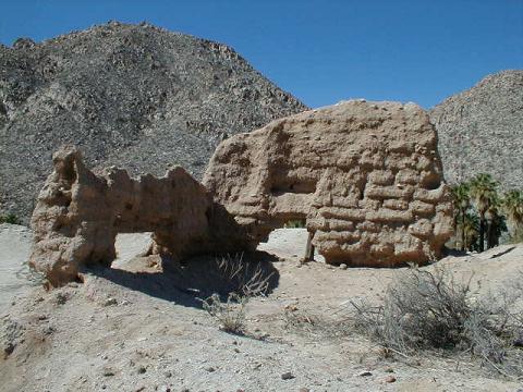
Closeup of the padre’s quarters and storeroom ruins, 2007.
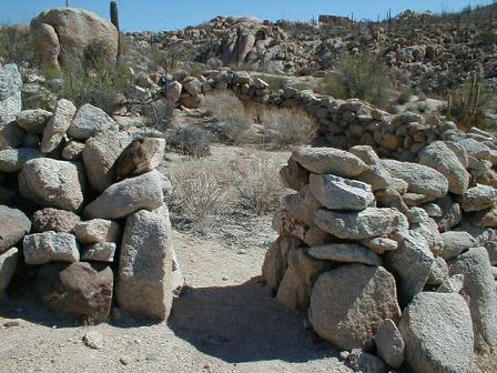
Corral made of stone near the adobes at Santa María.

The Tacoma climbs the ‘Widowmaker’ first and does it with ease (in 4WD low range with rear differential locked)! Photo by Roy from the bottom.
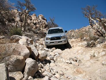
Elizabeth photographs me from the top as I near the end of the steepest part.
Roy’s new Land Rover (briefly on three wheels) does just fine with its special four wheel drive traction control system and his good off road driving skills!
Yes, it really is THAT steep!!!
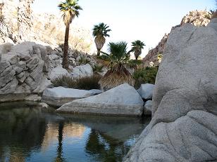
Blanche and Roy with an oasis beyond…
Water pours out of the granite all year long. A really special place in the desert, indeed!
It was a great trip and the big horn sheep were the icing on the cake!
Allow 3-4 hours for the 14.4 mile drive from Rancho Santa Ynez to Santa María. Have a sturdy 4WD vehicle with good tires (and a locking rear differential would be wise) before going.
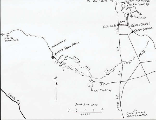
The map above is of the area around the mission. It shows our ‘oasis’ camp and the Camino Real location and ‘nearby’ highways Mex. 1 & 5, and Gonzaga Bay.

THANKS FOR VISITING! Road log and links follow>>>
ROAD LOG
- 0.0 Rancho Santa Ynez, take road through left gate, north of ranch.
- 0.9 FORK, go left/ uphill.
- 1.8 Deep Gully, 4WD climb out (if this scares you, go back!).
- 2.4 Rock pile, a road to left, go straight/ right fork.
- 4.7 Cement monument off to left (tracks continue past monument).
- 5.6 Arroyo crossing with palms.
- 9.9 Peninsular Divide, view of Punta Final on the gulf.
- 13.3 Top of the ‘Widowmaker’ grade.
- 14.4 MISION SANTA MARÍA
- 15.4 Road enters sandy Arroyo Santa María, after very steep downgrade.
- 15.7 Turn left, out of arroyo (may be hidden by plants). Tracks ahead in arroyo end in 1/4 mile.
- 15.9 El Camino Real climbs to the left, up hillside. The mission trail stays out of the canyon, along the north ridge and returns to the arroyo at the east end of the canyon.
- 16.0 Roadbed washed out. Park and hike on to end of bulldozed grade to see petroglyphs, canyon view, and the Indian trail (original El Camino Real) to canyon bottom, and Pozo de Escuadra oasis.
LINKS
- 1999 Trip (quad & m/c)
- 2003 Trip (2001 Tacoma)
- El Camino Real hike Nov.’03 (from Gonzaga side)
- 2007 Trip (2005 Tacoma)
- 2010 Group Trip to the mission (2010 Tacoma)
- 2022 Group Trip to the mission, one last time (I think)!
- Baja’s Spanish Missions
- Get my Baja Missions book!
- Baja Nomad Forums (trip reports and Baja discussion)
- VIVABAJA.COM (my Baja web site)