-
El Camino Real links at bottom of page…
Depending on the source, there were either 8 or 10 more missions established in Baja California after the Jesuits were removed from New Spain in 1768.
The first post-Jesuit mission was the only one founded in Baja California by the Franciscan Order, San Fernando Velicatá, in 1769.
In 1773, the California peninsula missions were handed over to the Dominican Order and the Franciscans continued establishing missions in Alta California.
The Dominicans established up to 9 new missions, with the final 2 being disputed by some historians as being simply new locations for Mission San Miguel.
The name and years for each mission will be followed by a recent photograph (taken between 2000-2018) then some will be followed by older photos to compare the sites. GPS waypoints are at map datum WGS84. Uncredited 2016-2018 photos by David Kier.
On the final page are links to more Baja California history web pages, including the mission visitas and detailed maps and satellite images of the Camino Real mission road.
Northern Baja Missions
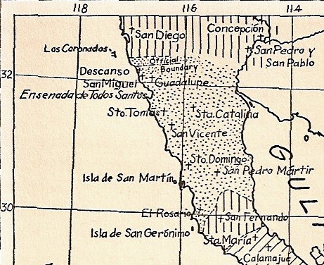
A close-up of Peveril Meigs map to show the location of the final 10 mission sites in Baja California, north of Santa María.
The final 10 Baja California missions
San Fernando Velicatá was the only Franciscan founded mission in Baja California. The Dominicans assumed control of the Baja California missions in 1773.
18) San Fernando Velicatá 1769-1818
19) Nuestra Señora del Rosario Viñaraco 1774-1832 (Moved 2 miles west in 1802)
20) Santo Domingo 1775-1839 (Moved 2 miles east in 1798)
21) San Vicente Ferrer 1780-1833
22) San Miguel Arcángel 1787-1834 (moved 7 miles west in 1788, and 8 miles north from 1810-1814)
23) Santo Tomás de Aquino 1791-1849 (moved 1 mile northeast in 1794, and 2 miles east in 1799)
24) San Pedro Mártir de Verona 1794-1806 (moved 7 miles south and nearly 2,000′ lower in elevation, after 3 months)
25) Santa Catalina Virgen y Mártir 1797-1839
26) El Descanso 1830-1834 [not a Spanish mission]
27) Nuestra Señora de Guadalupe 1834-1840 [not a Spanish mission]
The Franciscan and Dominican Mission Photos:
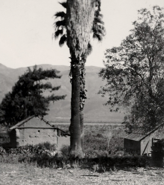
San Fernando Velicatá 1769-1818 (29°58’16.5″, -115°14’12.2″)


More photos of San Fernando: https://vivabaja.com/san-fernando/
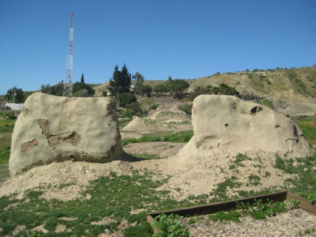
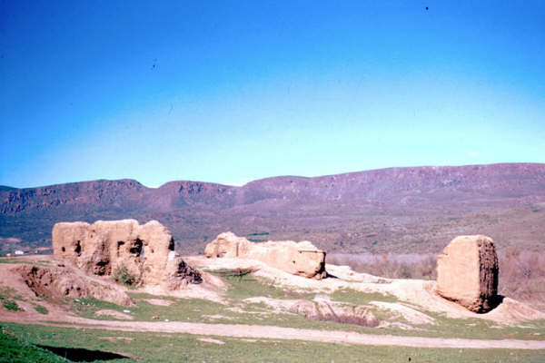
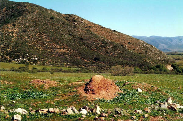
Nuestra Señora del Rosario Viñadaco 1774-1832
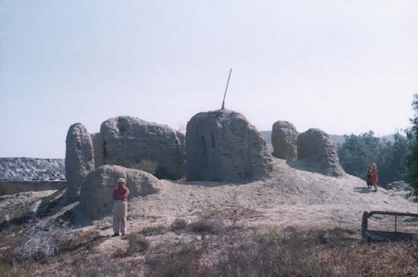
2005 photo by David Kier at the first site for the Rosario mission. GPS: 30°04’01.0″ -115°43’08.0″. In 1802, the mission’s water source became unusable. The mission was moved 2 miles down the valley, and nearer to the river.
2005 photo by David Kier, looking west.
2005 photo by David Kier, looking south.

1956 photo by Howard Gulick, looking west.
1957 photo by Howard Gulick, looking south.

1961 photo by Howard Gulick, looking east.
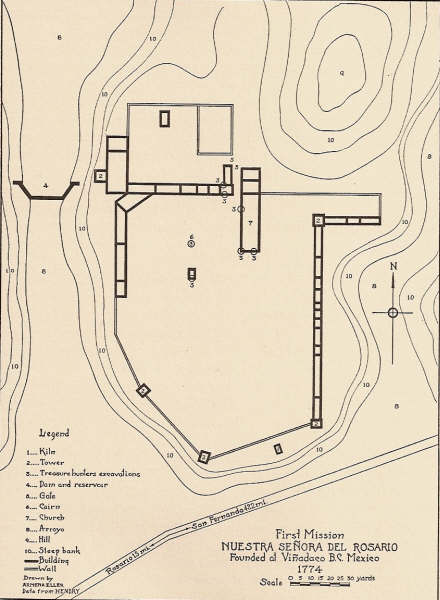
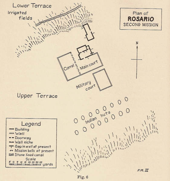
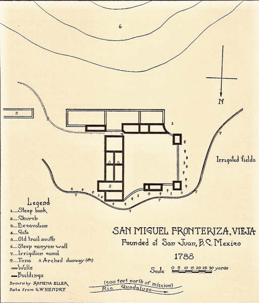
Mission floor plan from Peveril Meigs’ book showing the first site for the Rosario mission.
More photos: https://vivabaja.com/rosario-de-arriba/
Read more: HERE
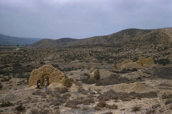
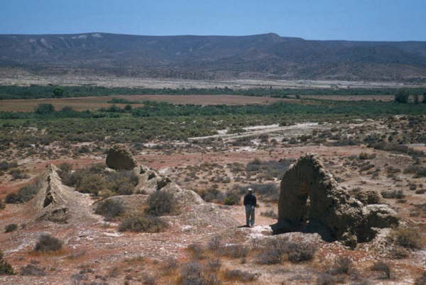
Second site for Rosario Mission 1802-1832
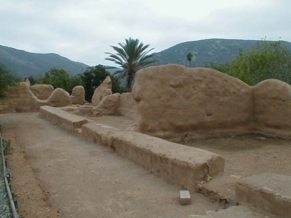
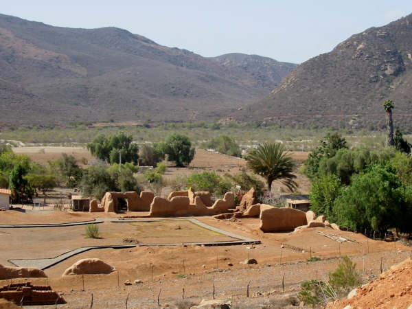
2005 photo by David Kier at Rosario de Abajo, near the south bank of the El Rosario River. GPS: 30°02’29.0″ -115°44’20.8″


1926 photo by Peveril Meigs

1930 photo by Margaret Bancroft
1949 photo by Marquis McDonald.
1958 photo by Howard Gulick.
Peveril Meigs’ plan for the second Rosario mission drawn from his investigation, in 1926.
More photos: https://vivabaja.com/rosario-de-abajo-in-photos-2004-2017/
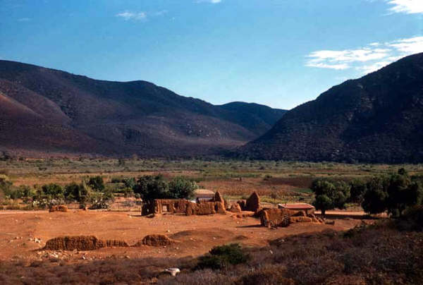
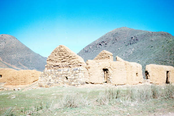
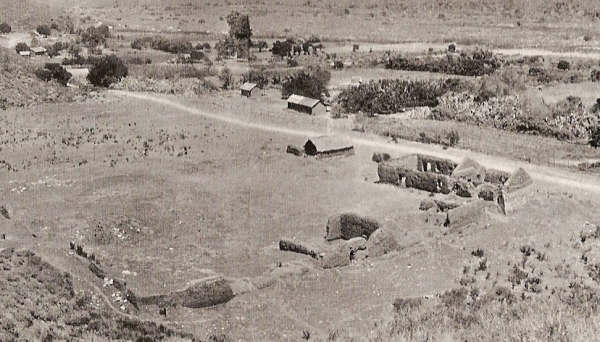
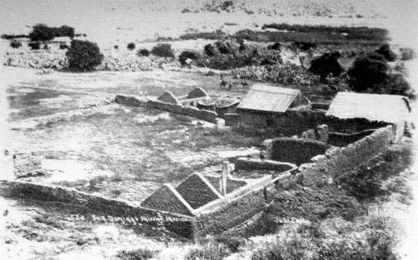
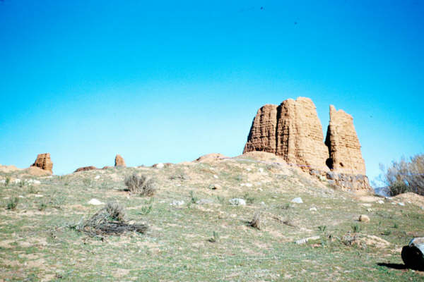
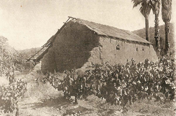
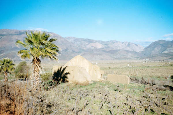
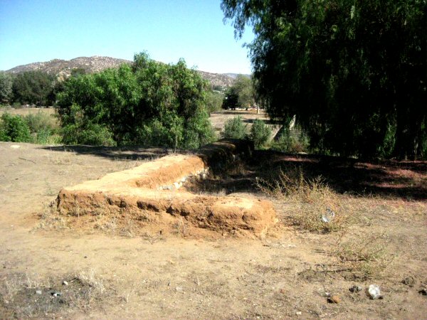
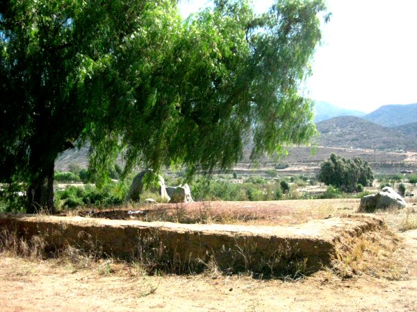
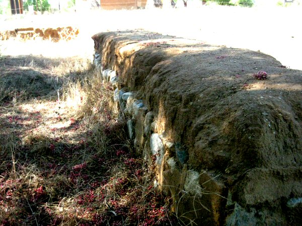
Santo Domingo 1775-1839
2005 Photo by David Kier, at the second mission site. GPS: 30°46’15.2″ -115°56’14.0″. The first site was just over 2 miles west and was moved here in 1798. The first site was at the west end of the canyon, near the cliff known as ‘Red Rock’.


In 2003 Jack Swords took this photo of Santo Domingo.
At nearly the same spot, but 49 years earlier, 1954 photo by Howard Gulick.
1949 photo of Santo Domingo by Marquis McDonald
1926 photo of Santo Domingo by Peveril Meigs
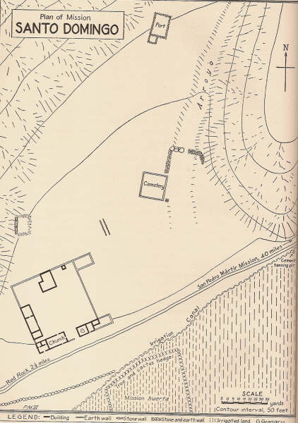
1926 plan of second site by Peveril Meigs
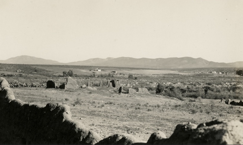
Santo Domingo in an 1886 photo sent in by Dr. Robert Jackson.
First Santo Domingo Mission Site (1775-1798)
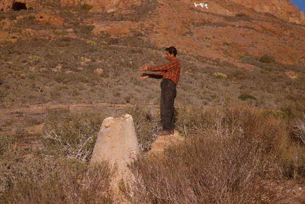
1955 Howard Gulick photo at the first site below ‘Red Rock’. Note the HR for Hamilton Ranch, once located just south of this spot.

1930 Margaret Bancroft photo of the Hamilton Ranch. ‘Red Rock’ is the cliff, seen just north.
More photos: https://vivabaja.com/santo-domingo-in-photos/
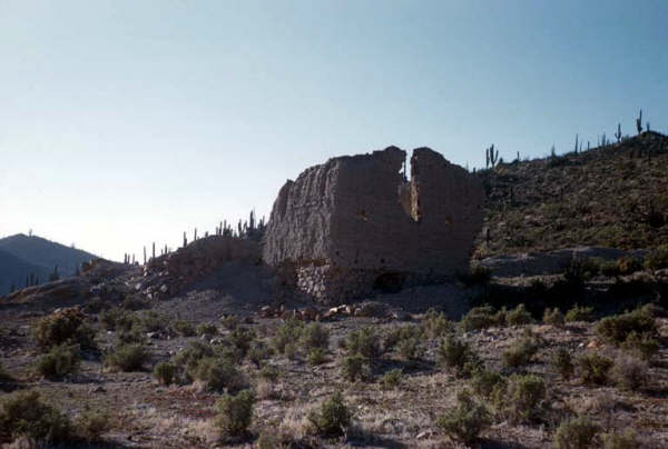
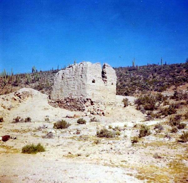
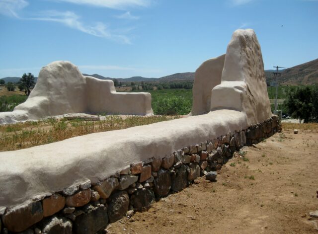
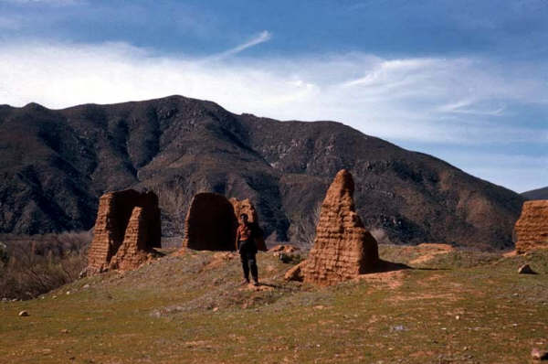
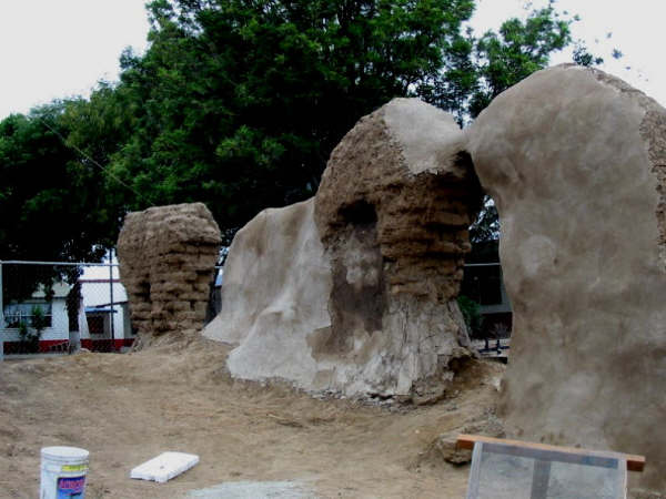
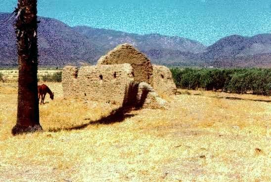
San Vicente Ferrer 1780-1833
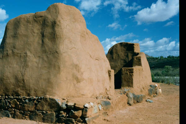
2003 photograph by Jack Swords (copyright). Mission adobe walls with protective coating to preserve what little remains of the mission complex. GPS: 31°19’47.9″ -116°15’33.0″

1930 Margaret Bancroft photo at Mission San Vicente Ferrer

1930 Margaret Bancroft photo of Mission San Vicente ruins
1949 Marquis McDonald photo
1955 photo by Howard Gulick
1955 Howard Gulick photo
Read more: HERE
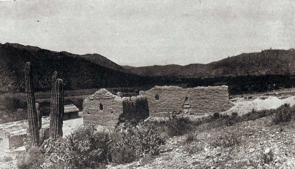
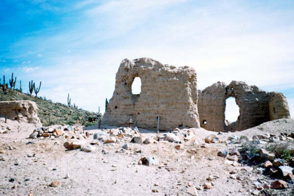
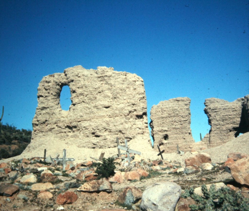
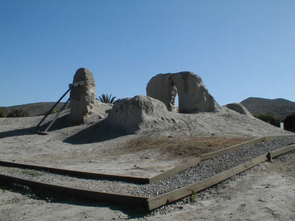
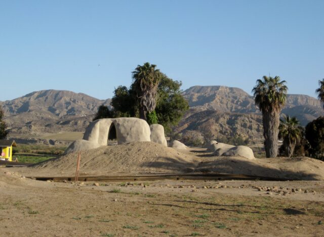
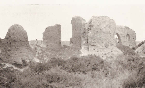
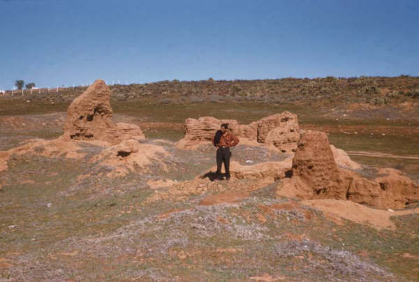
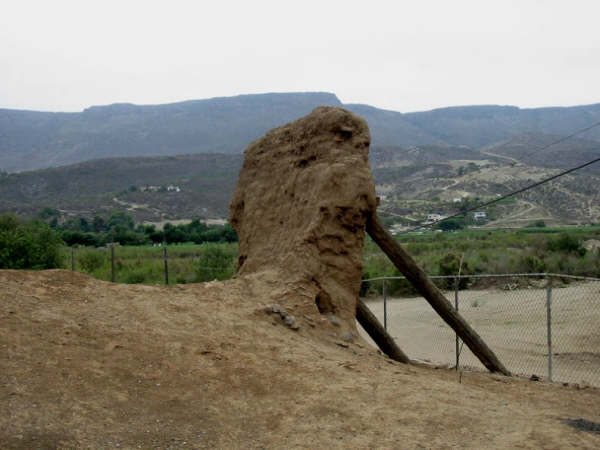
San Miguel Arcángel 1787-1834
First located 7 miles east, moved in 1788. Only a few walls reman along today’s ‘Ensenada free road’ (Mexico #1), in La Misión. 2003 photo by Jack Swords (copyright). GPS: 32°05’39.1″ -116°51’15.0″
The east church wall is saved by the supports added. 2003 photo by Jack Swords (copyright).
1949 photograph by Marquis McDonald of San Miguel mission ruins.
Plan of an Miguel site from 1926. Note that the map is oriented with south at the top.
Read more: HERE
More photos: https://vivabaja.com/san-miguel/
Santo Tomás de Aquino 1791-1849 (First site: 1791-1794)

2005 photo at the first mission site (#1) by David Kier. GPS: 31°34’11.0″ -116°28’50.0″
The Santo Tomás mission was first located some 2 1/2 miles west of the town of Santo Tomás. Two sets of ruins (1 mile apart) have been photographed and both called the first mission location (site #1 and site #2):
Peveril Meigs, in 1926 only documented site #2 and site #3. Meigs called site #2 the ‘first site’. Peter Gerhard (in 1956) and Michael Mathes (in 1977) do not mention site #2, only site #1 as the first site and a move in 1794 to site #3.
Zephyrin Engelhardt (1929) gives the year 1794 for a move “higher up” (p 575). Engelhardt (p 625) then provides the founding date of April 24, 1791, the first move in June, 1794, and a second move “on account of the lack of pastures” that was requested “8 years since the founding” (1799).
Site #1 is on the south side of the oak tree lined stream, on the valley floor. It should be considered the first location because mosquitos and flooding were reasons for a move “higher up”, made in 1794. The mountain blocking direct sunlight was also a concern, wrote one padre.
The move from site #2 (because of the “lack of pastures”) to the final site (#3) was made in 1799. Many adobe buildings were constructed there, yet almost nothing remains.

1977 photograph by Michael Mathes at the first site for Santo Tomás mission.
Second mission site 1794-1799
2009 photo at site #2 by David Kier. GPS: 31°34’24.3″ -116°27’58.7
1998 photo at site #2 by Kevin Clough

1949 photo at site #2 by Marquis McDonald. A photograph by Peveril Meigs some 25 years earlier shows nearly the same. The remains were plowed over and have vanished, about 2012.
Third Mission Site 1799-1849


Read more: HERE
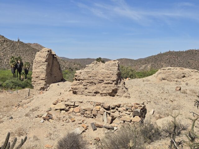
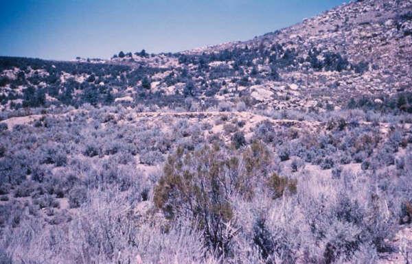
San Pedro Mártir de Verona 1794-1811
San Pedro Mártir is the most remote and difficult to reach mission on the peninsula. At 5,080 feet above sea level, reaching the mission requires 2 days of backpacking, from the nearest road. In 2004, Jack Swords and other Baja enthusiasts reached the mission, with guides from the Meling Ranch. GPS: 30°47’24.3″ -115°28’20.9″
Originally founded 7 miles north at La Grulla meadow, at an elevation of 6,800 feet. The mission was moved here after just 3 months because of the cold. Additional reading on both sites in links below. 2004 photos by Jack Swords.

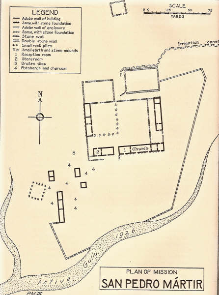
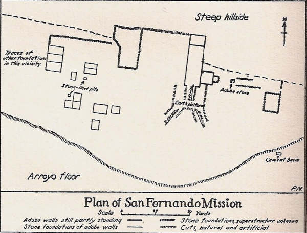
1926 mission plan by Peveril Meigs
2004 Misión San Pedro Mártir Trail Details |
|
|
|
|
|
|
|
|
|
|
|
|

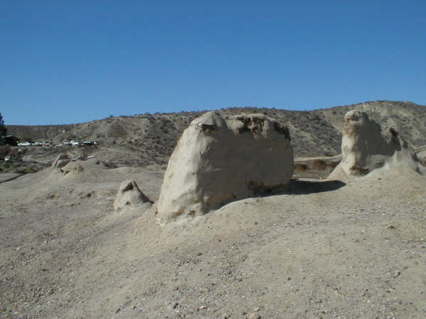
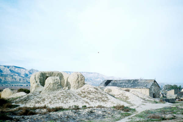
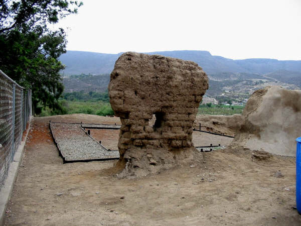
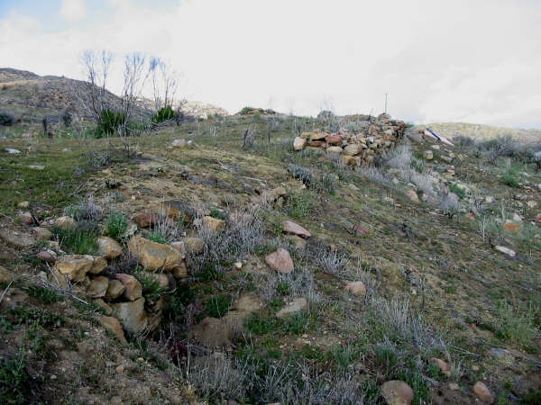
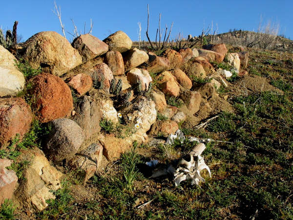
Santa Catalina Virgen Y Mártir 1797-1840
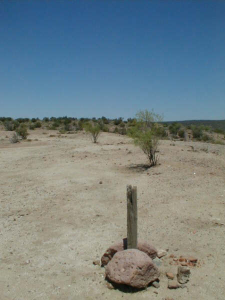

Located just outside of the village of Santa Catarina is the site of what some believe to be the last mission founded during the Spanish age in Baja California. Nearly nothing remains to show for the effort here. The stake is marking the southeast corner of the mission. 2006 and 2018 photos by David Kier GPS: 31°39’38.1″ -115°49’16.0″
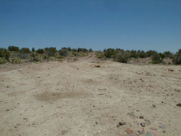

A small mound of adobe marks the lookout tower ruins at the northwest corner of the mission and fort of Santa Catalina. 2006 & 2018 photos by David Kier
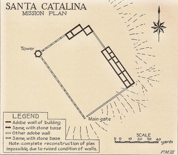
1926 mission plan by Peveril Meigs
Read more: HERE
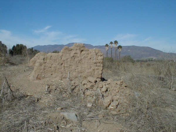
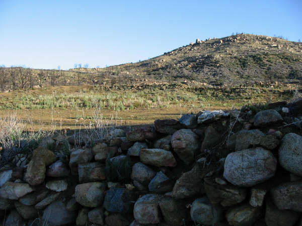
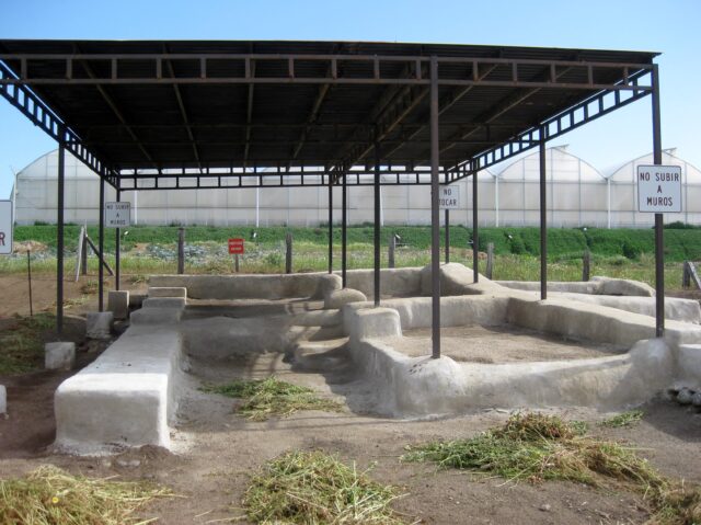
El Descanso 1830-1834
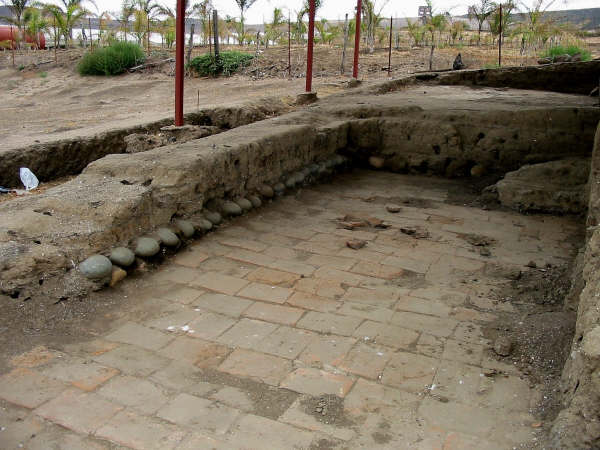
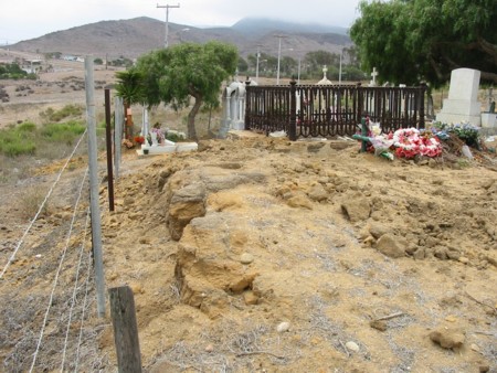
2003 photo by Jack Swords (copyright) at the newly uncovered mission tile floor. Now protected by an awning, the ruins are next to the modern church, just east of the Ensenada toll highway. GPS: 32°12’19.6″ -116°54’19.2″

Dominican mission records are lacking, and historians believe Descanso may have been only a new location for the mission of San Miguel, devastated by floods in 1809. The Descanso mission site was first located near the fort, on the south bank of the arroyo. In 1830, the final site was built.
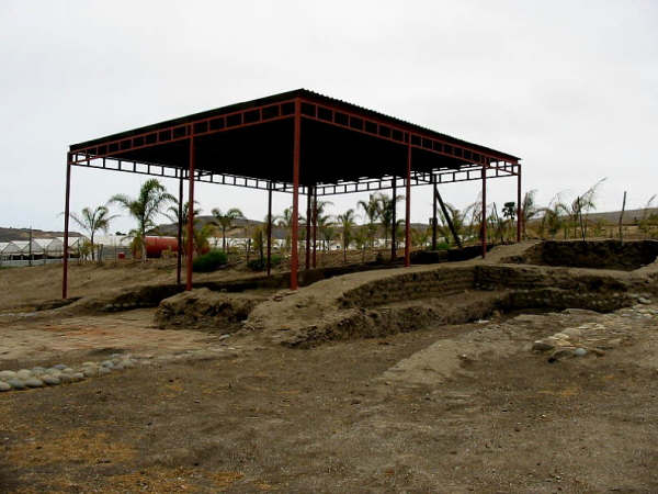
Photo by Jack Swords (copyright)


Ruins on the south bank of the Descanso valley where Peveril Meigs identifies a fort, in his 1927 photograph. Photo by Jack Swords (copyright) GPS: 32°11’59.4″ -116°54’30.0″
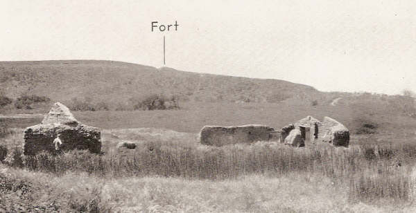
1927 photo by Peveril Meigs of Descanso and the fort location to the south is indicated (‘fort’ is the 1810-1815 San Miguel la Nueva mission site).
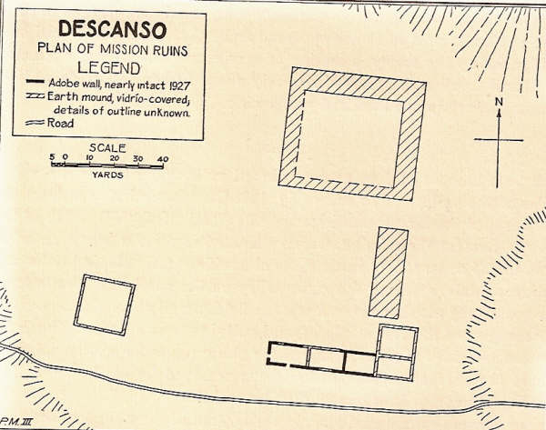
1927 mission plan by Meigs of the 1830 site for Descanso.
1949 photo of Descanso by Marquis McDonald
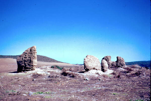
Descanso Fort (and mission location for New San Miguel, 1810-1815)
Read more: HERE
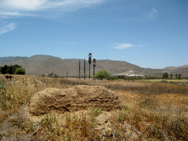
Nuestra Señora de Guadalupe 1834-1840
2012 photos by David Kier at the site of the last mission founded in all the Californias. Guadalupe was established following the closure of Descanso and San Miguel missions and is considered by some to be the final site of the mission of San Miguel Arcángel. Note: No remains from the mission here. Footings added at site in 1998 to simulate mission. GPS: 32°05’30.5″ -116°34’30.5″

To read more details on the fascinating history and events at the 27 Baja California missions, get my book, Baja California Land of Missions available from the publisher (with free domestic shipping) at www.oldmissions.com or your local book dealer, or online at Amazon.com, BarnesAndNoble.com, and SunbeltPublications.com. http://www.oldmissions.com/.
Primary books utilized for research include: ‘Antigua California’ by Harry Crosby, ‘Missions and Missionaries of California’ by Zephyrin Engelhardt, ‘The Dominican Mission Frontier of Lower California’ by Peveril Meigs, ‘Black Robes in Lower California’ by Peter Dunne… and more!
Read more: HERE
Baja’s mission visitas (visiting stations for missions) are in Part 3.
PART 3 The Mission Visitas
>>> See and order my book: Baja California Land of Missions <<
EL CAMINO REAL (satellite images and maps)
- Hiking the Camino Real and Google Earth Map
- Finding El Camino Real at road crossings
- Following El Camino Real on ’09 Baja Almanac & ’21 Benchmark Atlas
- El Camino Real on modern map
- HARRY CROSBY’s 1977 ECR Notes
- HARRY CROSBY’s 1977 ECR Maps
- HOWARD GULICK’s 1954 ECR Maps