Jesuit founded missions: This page
- PART 2 The Franciscan and Dominican missions
- PART 3 The Mission Visitas
- The Mission Road: El Camino Real
- PART 4: Mission’s GPS and Mission Sites viewed from Space
- New in 2026, Mission Albums: Photos from past to present plus history.
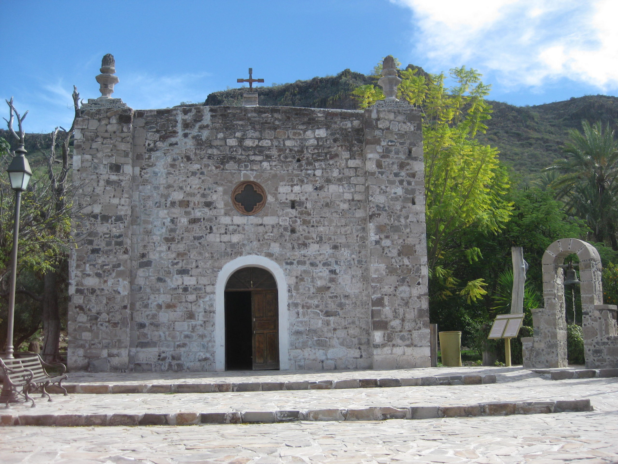
Santa María de los Angeles: the northern-most Jesuit founded mission in California. Photography by Jack Swords (copyright)
Photographs at each mission site taken between 1998 and 2008. Older photos (if available) will appear after recent photos in order to compare. A brief description of each mission follows the photographs. Unless otherwise noted, photographs are from Jack Swords and protected by copyright. Each mission will have its official name followed by the years it was in operation. GPS map datum set at WGS84.
Each mission photograph (from 2010-2019) can be viewed here from north to south: https://vivabaja.com/mission-site-photos/or on the Facebook group page: https://www.facebook.com/groups/bajamissions See the Albums section under Media, or use the search to find desired content.
A mission was much more than a church building, it was an organization, an outpost in the wilderness, and a center of ‘civilization’. The Jesuit missions were funded by donations of wealthy Europeans. The Spanish government wished to colonize California before the Russians or English did and the mission system was the method used to convert the native population. Instead, the diseases brought to California killed off the natives.
Besides the mission itself, there usually were several ‘visitas’ (mission visiting stations) for each mission where a chapel was built and the priest would visit and hold services. Some visitas were very large and their churches and functions resembled missions. A true mission was funded by an endowment, and historic records are clear that there were 17 Jesuit missions established and operated in California (today’s Baja California).
The list below includes some missions that changed their full name because of a relocation (#7, #9 and #17) thus each has a dual listing. Also, #13 (Santa Rosa at Todos Santos) was absorbed by the mission of Pilar de la Paz when Pilar de la Paz moved to Todos Santos.
1n 1683, Jesuits with Spanish soldiers first tried to colonize California. They first landed at La Paz Bay, but were soon forced to abandon that location. Months later, they tried again at San Bruno, just north of Loreto. The effort failed after two years and some ruins of the San Bruno fort were still visible until 2022 when the site was leveled and new walls erected to simulate the fort.
The Jesuits built roads to connect their missions and visitas. Many are easily seen today and make interesting hiking or mule riding adventures. The primary mission road in California is known as EL CAMINO REAL (The King’s Highway). See link to El Camino Real at the end.
The Oldest Spanish Ruins in Baja or Alta California: San Bruno


San Bruno web page: https://vivabaja.com/san-bruno-1683-1685/
Read more: HERE
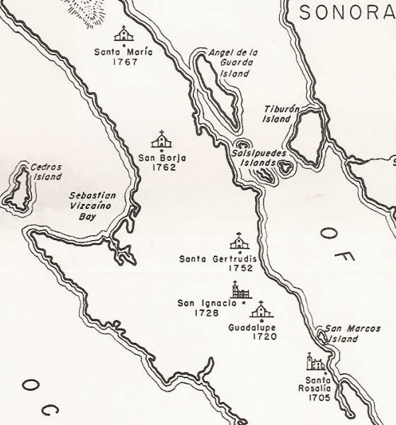
Map of Northern Jesuit California Missions
Map of Southern Jesuit California Missions
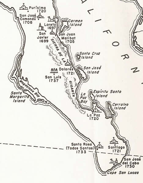
The 17 Jesuit Missions
1) Nuestra Señora de Loreto Concho 1697-1829
2) San Francisco Javier de Biaundo 1699-1817 (moved 5 miles south in 1710)
3) San Juan Bautista de Ligüí/ Malibat 1705-1721
4) Santa Rosalia de Mulegé 1705-1828
5) San Jose de Comondú 1708-1827 (moved 22 miles south in 1736)
6) La Purisima Concepcion de Cadegomó 1720-1822
7a) Nuestra Señora del Pilar de la Paz Airapí 1720-1748 (moved to Todos Santos in 1748)
7b) Nuestra Señora del Pilar de la Paz (Todos Santos) 1748-1840
8) Nuestra Señora de Guadalupe de Huasinapí 1720-1795
9a) Nuestra Señora de los Dolores Apaté 1721-1741 (moved to La Pasión in 1741)
9b) Nuestra Señora de los Dolores Chillá (La Pasión) 1741-1768
10) Santiago el Apóstol Aiñiní 1724-1795 (moved 2 miles south in 1734)
11) Nuestro Señor San Ignacio de Kadakaamán 1728-1840
12) San Jose del Cabo Añuití 1730-1748 & 1768-1840 (moved 5 miles north, then back, then 1 mile north)
13) Santa Rosa de las Palmas (Todos Santos) 1733-1748 (absorbed by moved La Paz mission in 1748)
14) San Luis Gonzaga Chiriyaqui 1737-1768
15) Santa Gertrudis 1752-1822
16) San Francisco de Borja Adac 1762-1818
17a) Calamajué 1766-1767 (moved 30 miles north in 1767)
17b) Santa María de los Angeles 1767-1774
>>> See and order my book: Baja California Land of Missions <<<
- PART 2: The Franciscan & Dominican Missions
- PART 3: Mission Visitas
- PART 4: Mission Sites viewed from space
- El Camino Real maps & images
Baja California Jesuit Mission Photos:
#1) Nuestra Señora de Loreto Concho 1697-1829

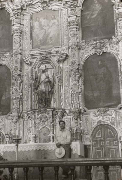
California’s first successful mission. Loreto is known as the ‘head and mother’ of all the missions in Upper and Lower California. The church construction was completed in 1752. In 1877, the bell tower was destroyed by an earthquake. The replacement was added in the mid 1950’s. GPS: 26°00’37.0″ -111°20’35.8″
Loreto mission in 1950 photo by Howard Gulick. The bell and clock tower was added before 1957.
Inside the Loreto mission in 1950. This Howard Gulick photo shows the church lacking a roof.
Read more: HERE
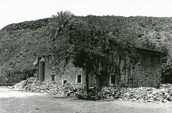
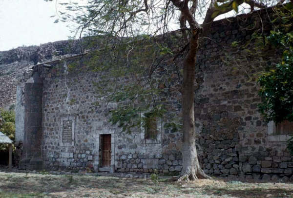
#2) San Francisco Javier de Biaundo 1699-1817
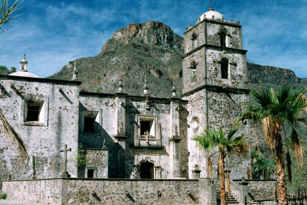
The second California mission was originally founded 5 miles north, but moved here between 1710 and 1720. The church was built from 1744 to 1758, and remains as the finest preserved stone mission in Baja California. GPS: 25°51’36.9″ -111°32’37.0″
1952 photo by Howard Gulick
Roof of San Javier mission in 1976 photo by David Kier.
Another rooftop photo by David Kier in 1976.
San Javier photos webpage: https://vivabaja.com/san-javier/
Read more: HERE
#3) San Juan Bautista de Ligüí/ Malibat 1705-1721

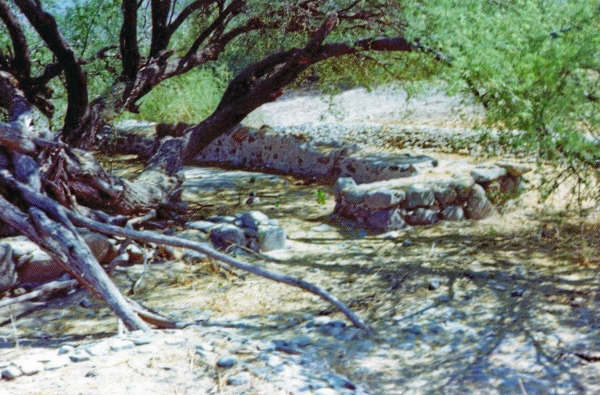
Originally home to the Monquí Indians who called the site Ligüí. The Cochimi called the site Malibat and soon replaced the Monquí at San Juan Bautista. The site proved to be a poor location and was abandoned in favor of establishing a new mission at Apaté (Los Dolores). The arroyo undermined the mission site and only some rubble from the foundation was visible in 2001. GPS: 25°44’22.2″ -111°15’51.0″
Ligüí mission foundation ruins in a 1975 photo from Southwest history professor, Robert H. Jackson.
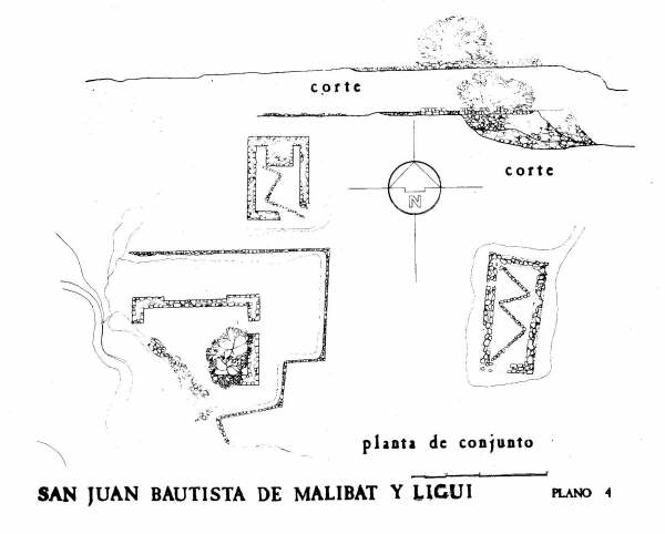
Ligüí mission ruin diagram (pre 2001 destruction).
Read more: HERE
#4) Santa Rosalia de Mulegé 1705-1828

The church was built in 1766. A flood in 1770 destroyed fields and almost caused the mission to be relocated to La Magdalena, some 15 miles to the northwest.

A 1930 photo by Margaret Bancroft at Mulegé
Read more: HERE
#5) San Jose de Comondú 1708-1827
Photo taken at ruins of the original location, now called Comondú Viejo. The mission was moved in 1736 to the visita of ‘San Ignacio’, 22 miles south. The mission name was not changed with the move. GPS: 26°16’27.4″ -111°43’08.5″
Comondú Viejo in 1956 photo by Howard Gulick.
Read more: HERE Additional photos: https://vivabaja.com/comondu/
San José de Comondú, final site in the town of San José Comondú

In the 1750’s, the largest mission buildings in California were constructed for San José de Comondú. All were torn down in 1936 except for this small side chapel, once attached to the larger church. GPS: 26°03’34.6″ -111°49’20.4″
The new mission location was only 2 miles from the San Javier mission visita of San Miguel. San Miguel may have served as the Comondú mission for a brief time until the nearby Comondú visita (named ‘San Ignacio’) was converted into the new Comondú mission.
Some books list San Miguel as a separate mission during the 1730’s because various Jesuits were stationed there and performed baptisms, etc..

Read more: HERE Additional photos and history here: https://vivabaja.com/comondu/
More images and history from Victor Du (link may not open on some browsers): HERE
#6) La Purísima Concepción de Cadegomó 1720-1822
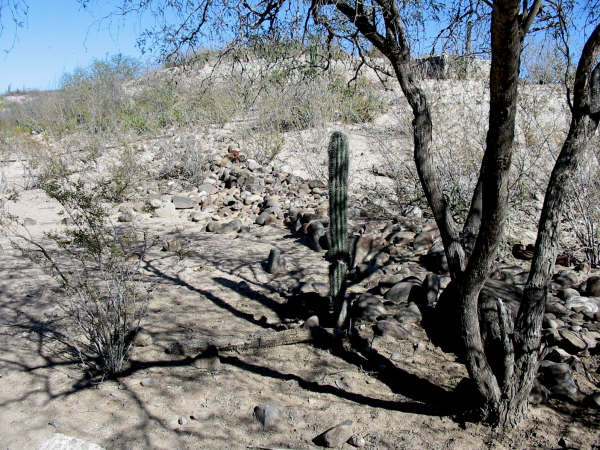
Photo taken at Purísima Vieja, some say was original site, where only foundation stones remain. Possibly a visita of La Purísima. GPS: 26°18’34.5″ -112°09’51.0″
The site of the Purísima mission only has some walls and graves to mark the location, in the town of La Purísima. GPS: 26°11’25.6″ -112°04’22.6″

La Purísima mission in 1906 photo by Arthur North.

La Purísima mission ruins in 1956. Photo by Howard Gulick.
Another Howard Gulick photo at La Purísima, in 1956.
Read more: HERE
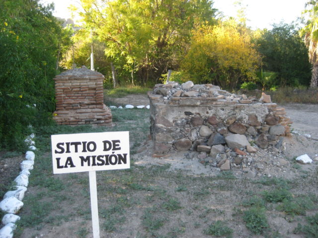
#7-a) Nuestra Señora del Pilar de la Paz Airapí 1720-1748*
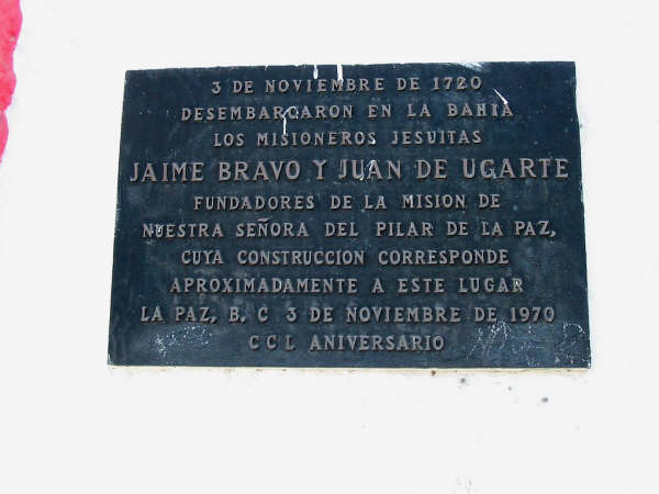
No remains of the mission overlooking La Paz Bay remain, just this plaque. GPS: 24°09’36.00″ -110°18’59.4″
*In 1748, the mission was moved south to Todos Santos and replaced the mission of Santa Rosa de las Palmas, there. #7-B location photos after Santa Rosa (#13, below).
Read more: HERE
#8) Nuestra Señora de Guadalupe de Huasinapí 1720-1795
Only some stone walls of the church, built about 1750, remain at this mountain mission. Photo from 2019 GPS: 26°55’6.35″ -112°24’21.70″
Guadalupe ruins in 1953 photo by Howard Gulick
Read more: HERE
#9-a) Nuestra Señora de los Dolores Apaté 1721-1741*
Originally established close to the gulf coast, Dolores was soon moved to this spot about 3 miles west. *In 1741, a third move was made to the Dolores visita of La Pasión in the region called Chillá (see below).
Los Dolores is often called ‘Dolores del Sur’ because the Jesuits had a visita north of Loreto named Dolores.
Photo taken from the ridgetop west of the mission. This mission and San Pedro Mártir are the only two not accessed by an automobile road. GPS: 25°03’19.0″ -110°53’03.3″
#9-b) Nuestra Señora de los Dolores Chillá 1741-1768

The final move for the mission of Los Dolores was over 15 miles to the southwest, in the region called Chillá by the Indians. This mission location was usually called ‘La Pasión’, the name of the visita that was here. Some books list a separate mission of ‘La Pasión’ instead of this being the final location for Los Dolores. GPS: 24°53’14.4″ -111°01’49.8″

1949/1950 Marquis McDonald mission expedition photograph of Los Dolores Chillá (La Pasión) ruins.
Read more: HERE
#10) Santiago el Apóstol Aiñiní 1724-1795
Established here in 1724 after the mission failure at Santa Ana in 1722. About 1734 the mission was moved 2 miles south where the town is today. Another move in 1790 to Cadueño is reported by some historians.
Only foundation stones were seen at the first site. It is now a ranch where visitors are not welcome, so no GPS here. The Santiago town church is on the second site.

Read more: HERE
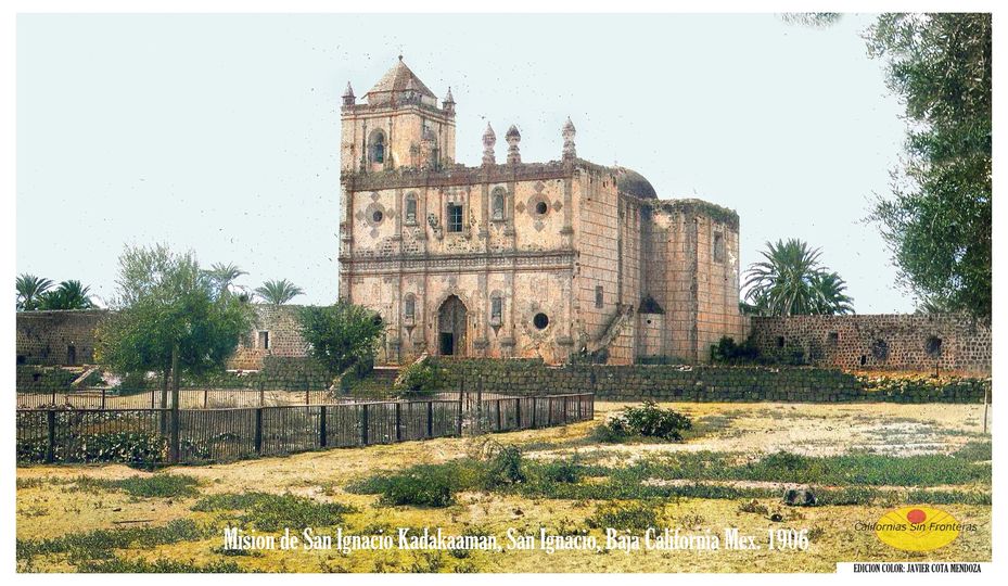
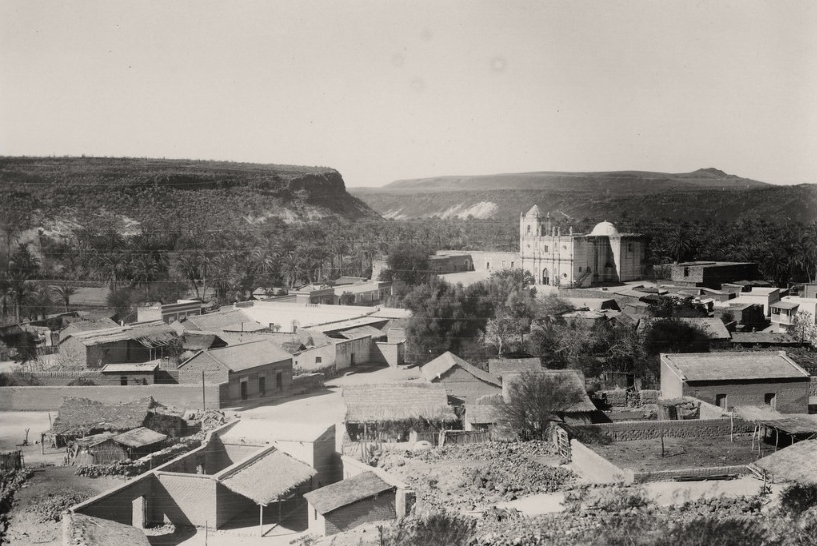
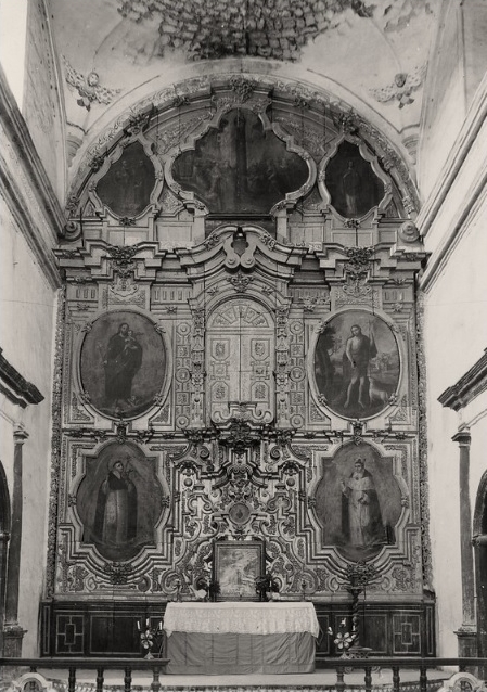
#11) San Ignacio de Kadakaamán 1728-1840

The massive stone church was completed 58 years after its founding. The Dominicans finished the work in 1786. San Ignacio was the northern-most California mission for 23 years. Located in the town plaza of San Ignacio and surrounded by an oasis in the desert. GPS: 27°17’02.2″ -112°53’56.1″
The next four San Ignacio photos, taken around 1930, come from Griffing and Margaret Bancroft:

Read more: HERE
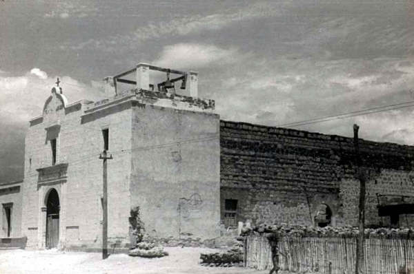
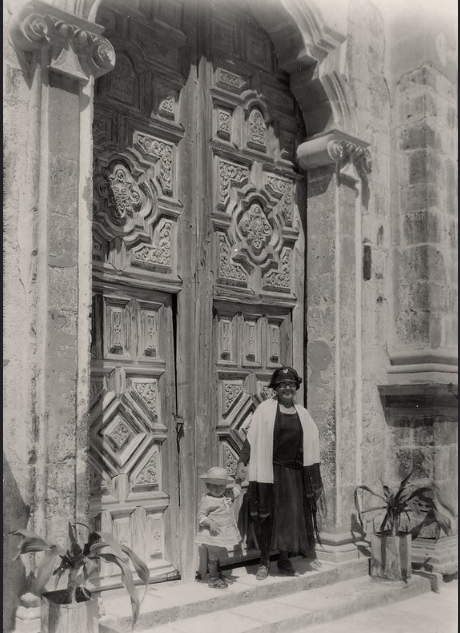
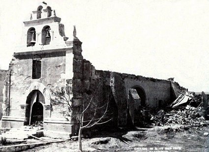
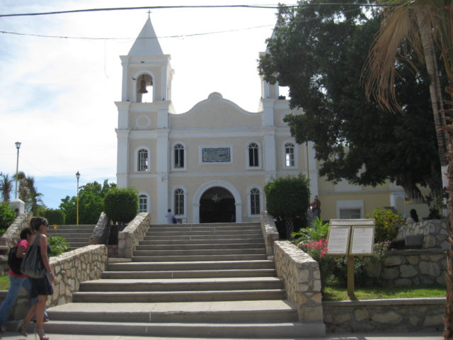
#12) San Jose del Cabo Añuití 1730-1748 & 1768-1840
Photo from 1919, showing the damage from the hurricane of 1918. The modern town church was built on this site. No ruins remain at any of the mission’s known locations, so no GPS data. San Jose was first established near the coast, but soon moved 5 miles inland (today’s San Jose Viejo).
The mission was moved back to coast in 1735, and a final move 1 mile inland was made in 1753, when it was a visita of Santiago.
Read more: HERE
#13) Santa Rosa de las Palmas 1733-1748

This playground along Hwy. 19 was the location of the mission. A modern church is just behind. Established at the La Paz mission visita of Todos Santos, in 1733. Fifteen years later, the mission at La Paz moved here and the Santa Rosa mission name changed. See below. GPS: 23°27’37.3″ -110°13’08.3″
Read more (same as Mission #7-a): HERE
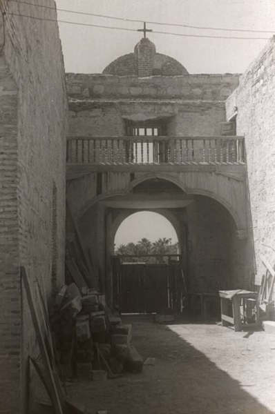
#7-b) Nuestra Señora del Pilar de la Paz (Todos Santos) 1748-1840
When the mission of La Paz moved south, the mission of Santa Rosa was replaced. In 1825, the mission moved again, about 1 mile south. Church in the photo was built in 1970 at the first Todos Santos site. The final site is occupied by the expanded mission church, seen below:


Below, is the above Todos Santos church in a 1919 photo.

Read more (same as Mission #7-a): HERE
#14) San Luis Gonzaga Chiriyaqui 1737-1768

Established at an oasis visita of the Los Dolores Apaté mission. The stone church was built in the 1750’s. GPS: 24°54’29.0″ -111°17’27.3″

Read more: HERE
#15) Santa Gertrudis 1752-1822
When a new mission to the north was planned, it was given the name ‘Dolores del Norte’ and it appears on the Jesuit mission list of 1745 and the map of 1757 (drawn from 10 year old information). When the funds for the new mission were donated by the Marques de Villapuente, he requested it be named Santa Gertrudis. GPS: 28°03’04.0″ -113°05’07.2″
Ironically, some maps and books show a separate mission of Dolores del Norte between San Ignacio and Santa Gertrudis.
In 1964, the people of San Francisco de la Sierra informed their first outside visitors (Choral Pepper and others) the old walls in their village were the remains of ‘Dolores’. San Francisco may have been an early site? Visita ruins in San Pablo canyon, below San Francisco, have also been named Dolores del Norte.
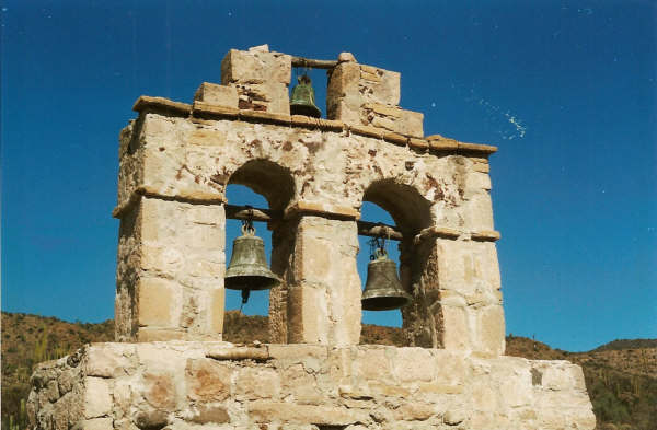
The mission bells are detached from the church at Santa Gertrudis. One of the bells is cast with the name ‘Santa Maria Magdalena 1739’, another proposed mission shown on the Jesuit map to the north of here. Ruins found in 1966 may be the Magdalena abandoned mission project (see vivabaja.com/109). Photo by Kevin Clough.
My Santa Gertrudis photos album: https://vivabaja.com/santa-gertrudis/
Read more: HERE
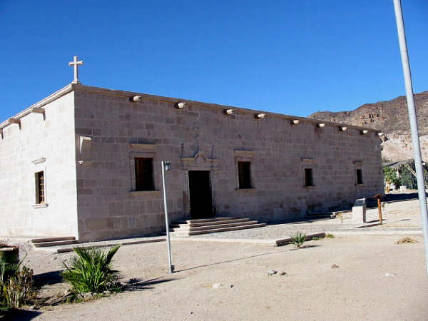
#16) San Francisco Borja de Adac 1762-1818
Founded by the Jesuits just six years before they were removed from New Spain, San Borja has extensive adobe ruins behind the Dominican built stone church . A metal awning now protects some of adobe walls, believed to be of Franciscan origin (1768-1773) or previous Jesuit work.
The stone church at San Borja was built by the Dominicans until the construction stopped in 1801. The planned bell tower is the only missing part. GPS: 28°44’40.4″ -113°45’14.4″
San Borja photo by Howard Gulick taken in 1952
San Borja adobe mission ruins in 1954 photograph by Howard Gulick.
My album photos at San Borja (2001-2017): https://vivabaja.com/san-borja/
Read more: HERE
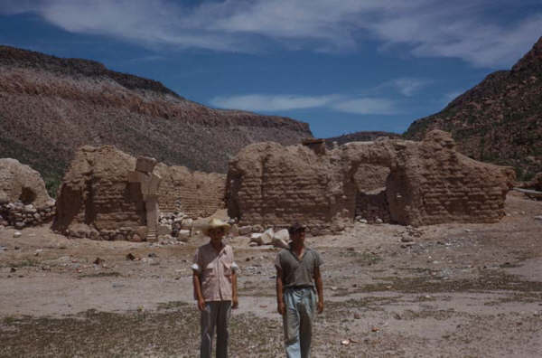
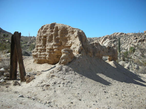
#17-a) Calamajué 1766-1767
The first location for the next mission north of San Borja proved unfit because the water was so mineralized it prevented agriculture. After 7 months, the mission was moved. GPS: 29°25’16.3″ -114°11’42.4″
Calamajué ruins in 1949. Photo by Marquis McDonald
Read more: HERE
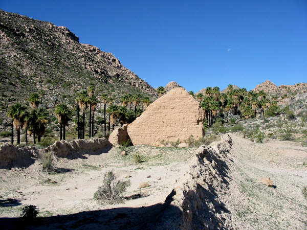
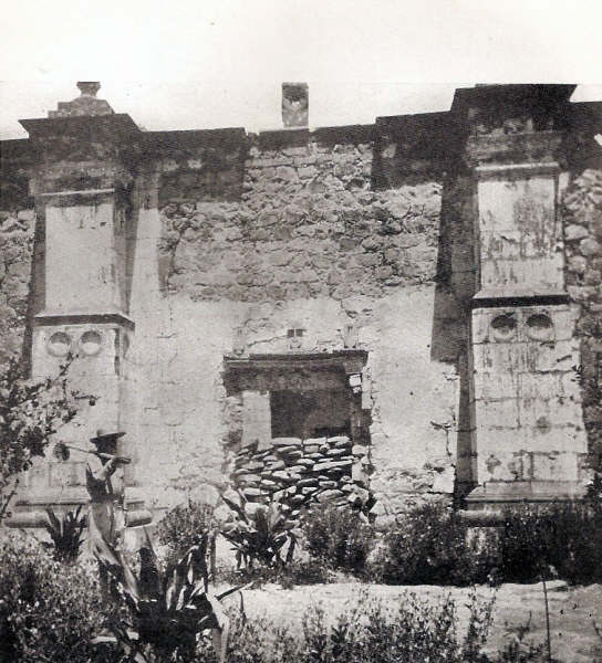
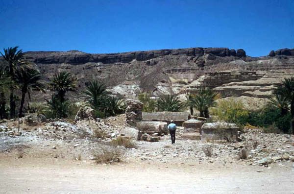
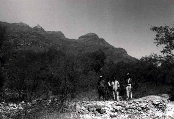
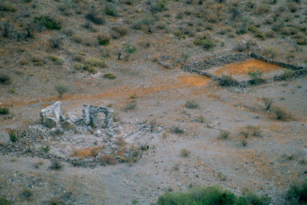
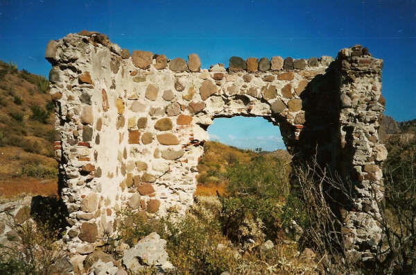
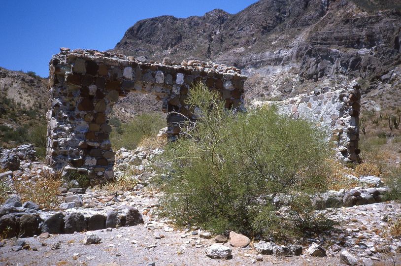
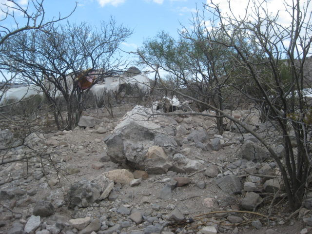
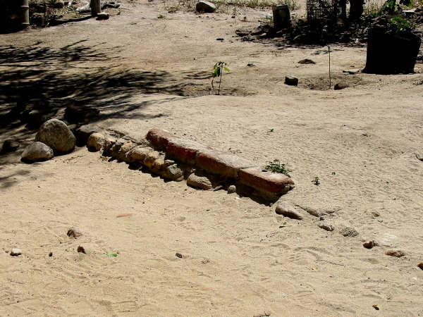
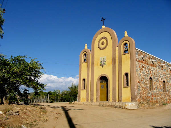
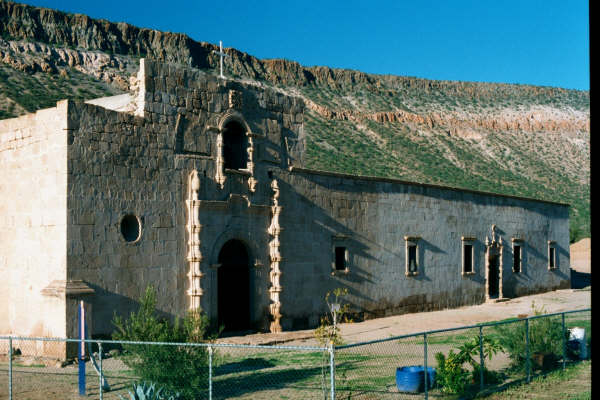
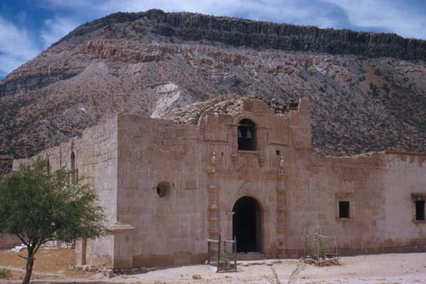
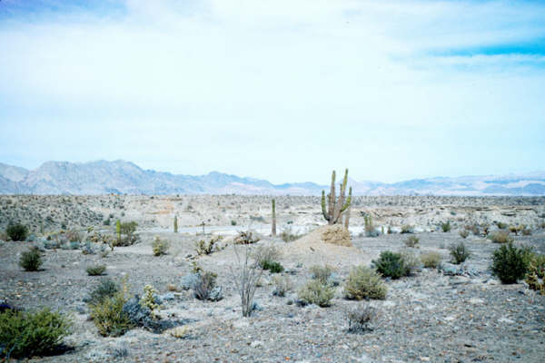
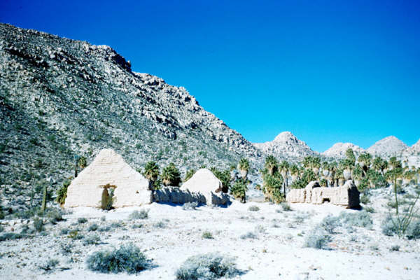
#17-b) Santa María de los Angeles 1767-1769
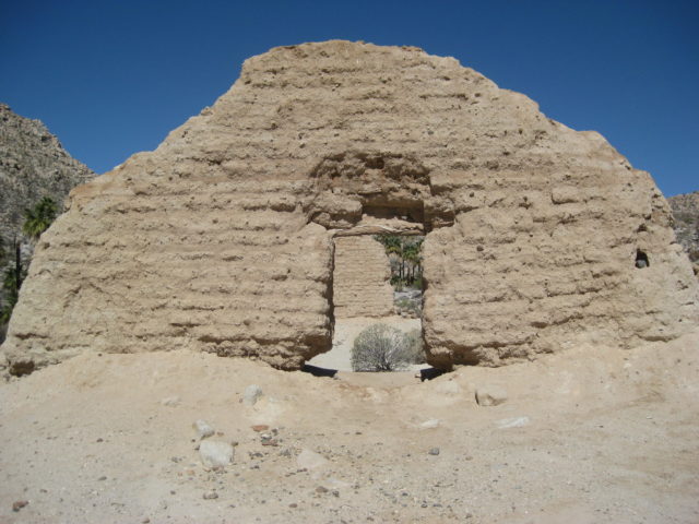
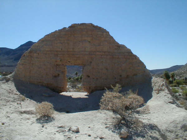
When crops wouldn’t grow at Calamajué, the Indians showed the Jesuits their oasis of Cabujakaamang 20 miles north, with its sweet water. The Jesuits moved their mission and had only constructed palm log shacks when they were removed from California, in early 1768.
The Franciscans who replaced the Jesuits built the adobe ruins that we see here. Santa María had a very brief mission history. In 1769, the first Franciscan mission in California was founded by Junipero Serra some 35 miles away. Named San Fernando by Father Serra on his long walk from Loreto to Alta California. San Fernando was a superior mission site and eventually, Santa María was abandoned. Photos taken in 2007 by David Kier. More photos at http://vivabaja.com/msm GPS: 29°43’54.5″ -114°32’50.2″
The padre’s quarters and storeroom ruins at Santa María.
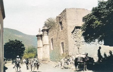
1949 Marquis McDonald photograph of Santa María mission.
My album photos at Santa María (1999-2022): https://vivabaja.com/santa-maria/
Read more: HERE