David K & Lorenzo de Baja, July,2000Exploring Baja California’s interesting and little known sites was our goal. Because Baja is the world’s longest peninsula, we had to limit our journey to just a small area for the available time. Our trip started July 22 and ended on July 28, 2000. The following pages have 26 or so photographs taken by myself (David K) or Lorenzo, and scanned by Wild Bill. Text with each photo will detail what, where, and when…maybe who and why, too! Jack Swords proved the onyx dome’s existence with his (included) photograph at El Volcán, in 1995. Please email any questions to me at: David K. At the end of this page, there are some Baja Website Links, including my main ‘homepage’ and my 1999 exploration of Misión Santa Maria, with ‘Baja Mur’. Remember: “When you come to a fork in the road, take it!”
TRIP ROUTE 2000
Sat. 7-22 Alta California to Tijuana, Ensenada (toll hwy.), Santo Tomas. Sun. 7-23 Santo Tomás to El Rosario, Punta Baja, El Rosario, Km 80+, Punta San Carlos. Mon. 7-24 Punta San Carlos, Las Pintas, Hwy.1(Km 80+), El Progreso, El Mármol, El Volcán. Tue. 7-25 El Volcán, El Mármol, Café ‘Sonora’, El Progreso, Misión San Fernando & petros, Mina San Fernando, El Progreso, Km.103+, El Metate, San Juan de Dios. Wed. 7-26 San Juan de Dios, Km. 103+, El Rosario, San Quintin, San Telmo, Meling Ranch, Los Manzanos. Thu. 7-27 Los Manzanos, Observatorio, Meling Ranch, San Vicente, Erendira, Baja Malibu Sur. Fri. 7-28 Baja Malibu Sur, Ensenada, Tecate, Choral Pepper’s, Home!
ARE YOU READY TO GO TO BAJA?

WELL, OKAY THEN…FASTEN YOUR SEATBELT!

Punta San Carlos

From the point, looking east towards the fishing village and Mesa San Carlos. Behind me, a half mile is the board sailing resort, Solo Sports. http://www.solosports.net/(7-23-00)
The Road to Las Pintas
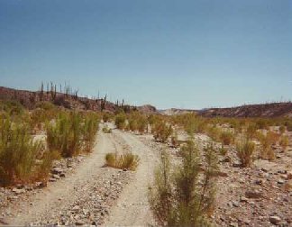
Eighteen miles from Hwy.#1, about half way to Punta San Carlos, this road turns left and follows the Arroyo San Fernando eastward. (7-24-00)
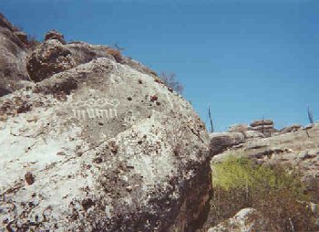
Las Pintas
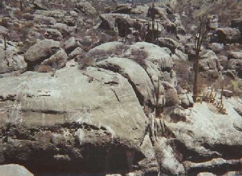
At the end of a box canyon, just north of Arroyo San Fernando, is this fascinating pile of boulders with many petroglyphs and fossils. A waterfall is usually present, but this year was very dry.
Giant boojum growing from Las Pintas boulder
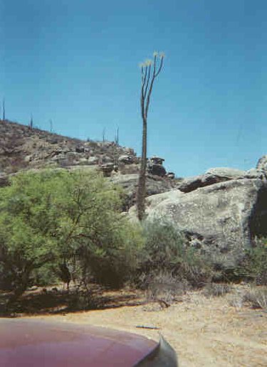
The road ends by the shady mesquite tree. Time to get out and explore! (7-24-00)
Las Pintas Squeeze
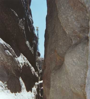
Passages over, under, or between the boulders make this ‘Nature’s Disneyland’! Can you see Lorenzo at the far end? (7-24-00)
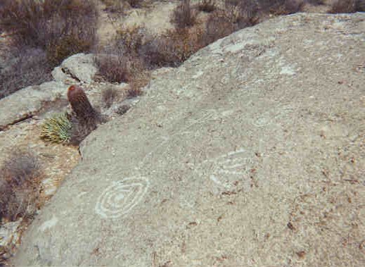
Las Pintas Petros-1
Also interesting are the fossil oyster shells in the boulders! (7-24-00)
Las Pintas Petros-2
A ‘mano’ and rings etched into a boulder at the top of Las Pintas. The plain behind, ‘funnels’ any ground water to the top boulders. Water is forced to surface, and falls to the bottom. Just not this time!
El Mármol

The world’s only schoolhouse made of onyx. Slowly being destroyed. David K in front. The road to El Volcán goes over the rise, to the left of the schoolhouse. (7-24-00)
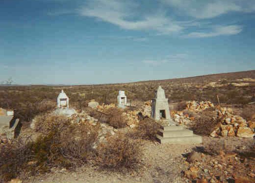
El Mármol Graveyard 7-25-00
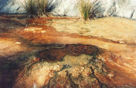
Near El Volcán
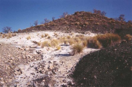
Just over 4 miles from El Mármol, the process of making onyx can be seen. (7-24-00)
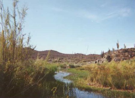
Near El Volcán: Onyx Springs
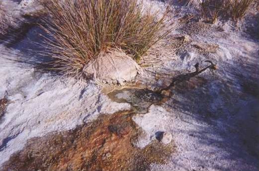
About 5 of these tiny springs can be seen on this hillside. The geyser and ‘onyx dome’ eluded us on this trip. (7-24-00)
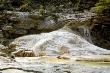
The ‘Onyx Dome’ in 1995. Jack Swords photo.
What Lorenzo and I couldn’t find! It is up the arroyo the road crosses 2/10ths a mile before the hillside with the springs, in my photo. Thanks Jack! I re-visit El Volcán and find the ‘dome’, in 2003: http://davidksbaja.com/403/
Misión San Fernando
Very little is left standing at this, the first mission established by Father Junipero Serra on his walk from Loreto to Alta California. (7-25-00)
San Fernando Petros-1

Notice the human figure to the right, and the modern addition on the left. The rest (in this pic) is as it was since I first saw these, in 1974. (7-25-00)
San Fernando Petros-2

Perhaps the spaceship on the left rock explains why the right rock has Roman numerals (from pre-Columbian artists!)….(7-25-00)
Mina de San Fernando

A copper mine in operation in 1918 (David Goldbaum, ‘Towns of Baja Ca.’) The ore was transported to the ‘port’ of San Carlos for shipment. (7-25-00)
Mine Shaft

We saw two open shafts…watch your step! (7-25-00)
Boojum Forest
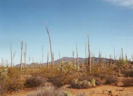
Along the road to San Juan de Dios. I love these crazy plants so much…wish I had more film! Nothing says “Baja” quite like a boojum! (7-25-00)
San Juan de Dios, visita ruins-1
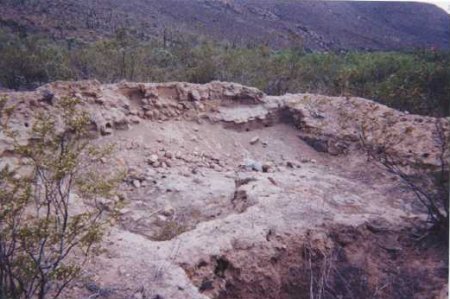
This was the largest room, in the middle of the long building ruins. This visita served Misión San Fernando in the early 1800’s. (7-25-00)
San Juan de Dios, visita ruins-2
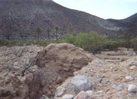
A room dividing wall. Beyond note the square pits which were rooms in this long building. Picture facing NNW, note some of the date palms near the arroyo and pools. Adobe is built on stone foundation. Some plaster/ paint is visible on inside walls! (7-25-00)
‘Fording’ the Arroyo San Juan de Dios.
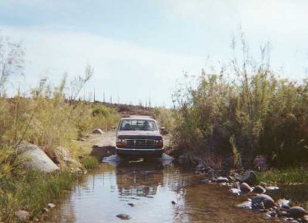
Lorenzo brings his mighty truck across a desert river. Only 5.1 miles north from Hwy.1 (Km. 103+), with boojums all around! Imagine if it had been a wet winter! (7-26-00)
Ducks in Boojum Land!
The pond east of the arroyo crossing is a convenient resting spot for these two ducks. Look for the pair of water splashes…(7-26-00)
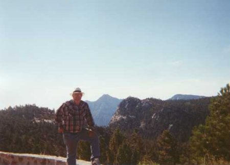
Sierra San Pedro Mártir
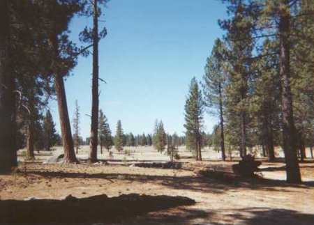
Vallecitos Meadow along the observatory road. Can you believe we are STILL in Baja? (7-27-00) The end of the road, elev. 9,280 feet ASL. Below, is Diablo Dry Lake and beyond the upper gulf. I have been here on very clear days and seen across to Sonora! Very hazy today…(7-27-00)
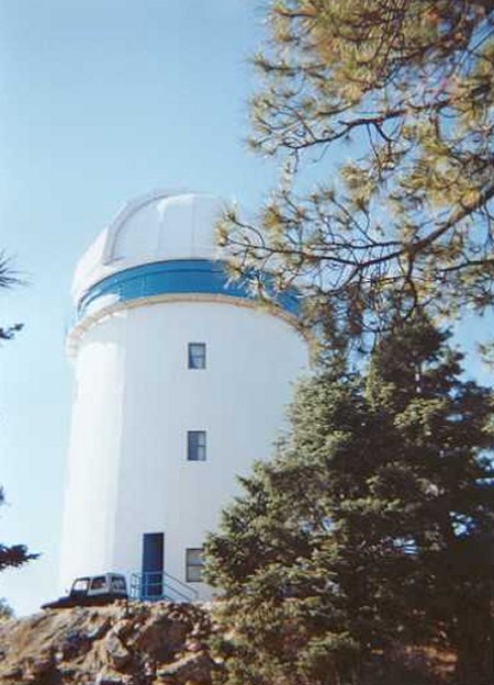
Observatorio
Lorenzo and The Devil!
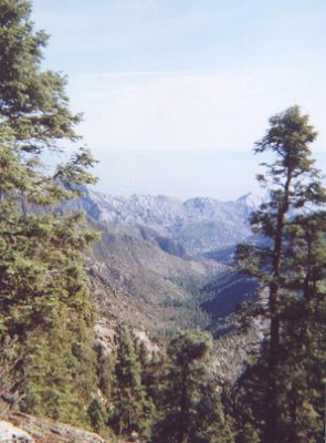
Master Baja Explorer and Trip Pilot, Lorenzo de Baja. In the background is El Picacho del Diablo, elev. 10,154′, Baja’s mightiest peak. San Felipe is beyond the far side of Diablo. (7-27-00)
BAJA CALIFORNIA ? YES!
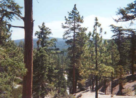
From Cardón and Boojum forests to Pine forests…Baja Has It! Sierra San Pedro Mártir (7-27-00)
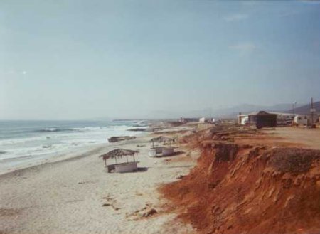
Baja Malibu Sur, beach (7-27-00)
Thank you for visiting this website. I may add more photos or text in the near future. So, please bookmark this site and come back to (David & Lorenzo’s) Baja once in a while !