2016 Trip photos: Roads and side trips of Baja California All content by David Kier
The Baja Extreme 2016 (September 9-19)
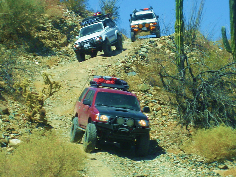
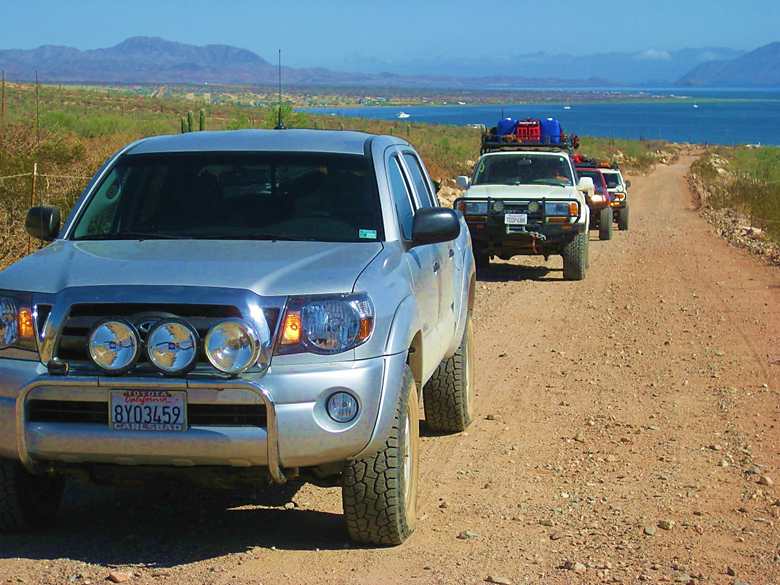
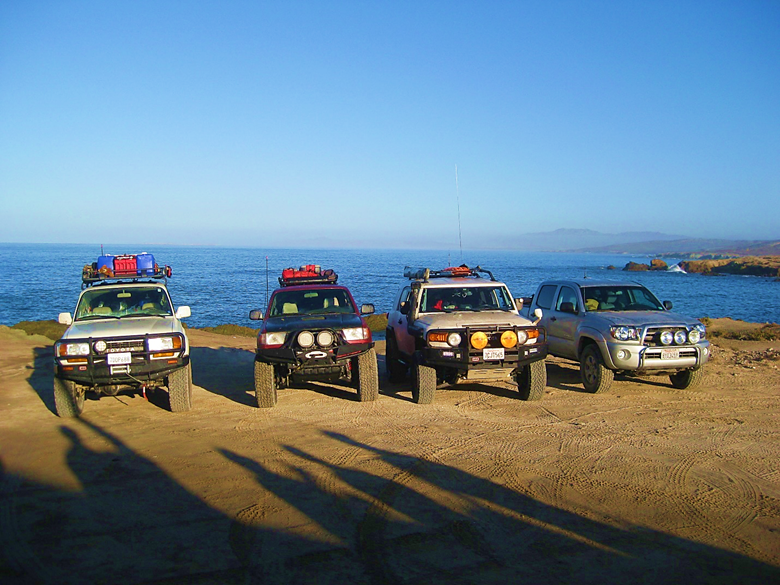
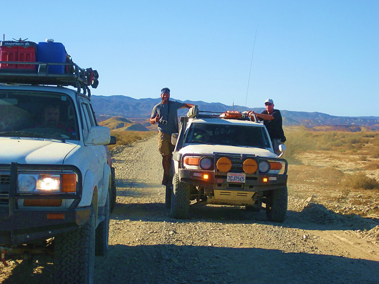
Eight people in four off-road-ready Toyotas made exploring Baja California their goal. We traveled to as many sites as I could fit into the time we had on the peninsula. We saw six Spanish mission sites, a giant painted cave, beautiful beaches, petroglyphs, and fossils. Have a look at some of the best adventure that can found in Baja California: For ten days, four well-prepared Toyota 4X4s traveled and explored some of the best that Baja California has to see and do in 10 days of travel and fun. Enjoy a few photos and some great videos
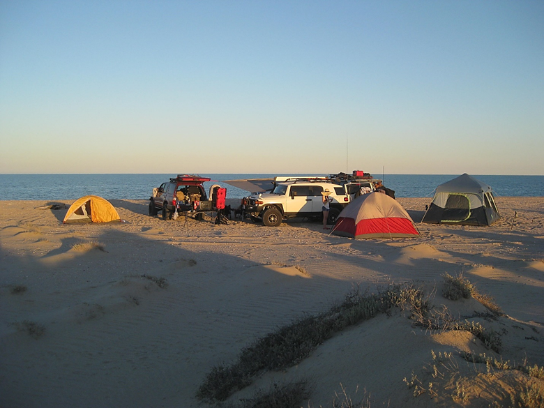
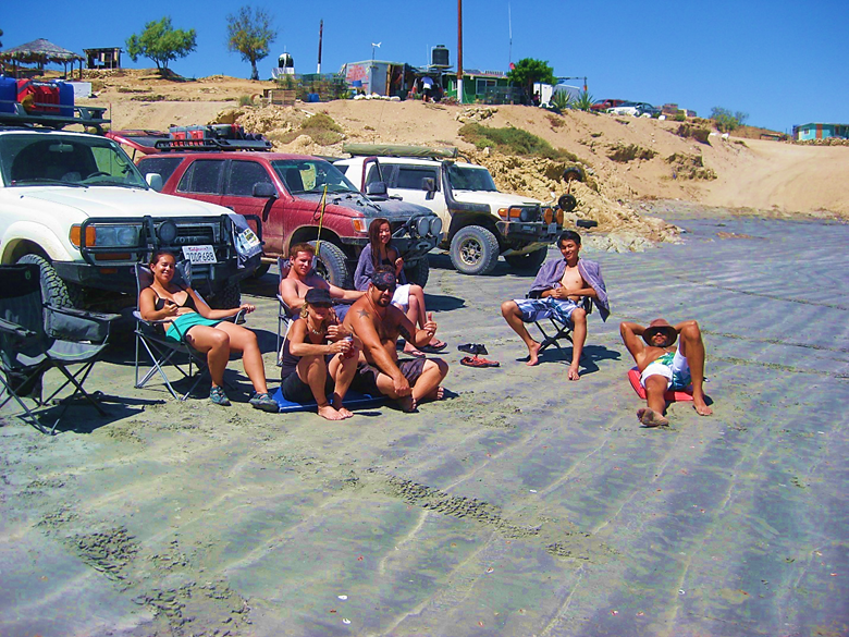
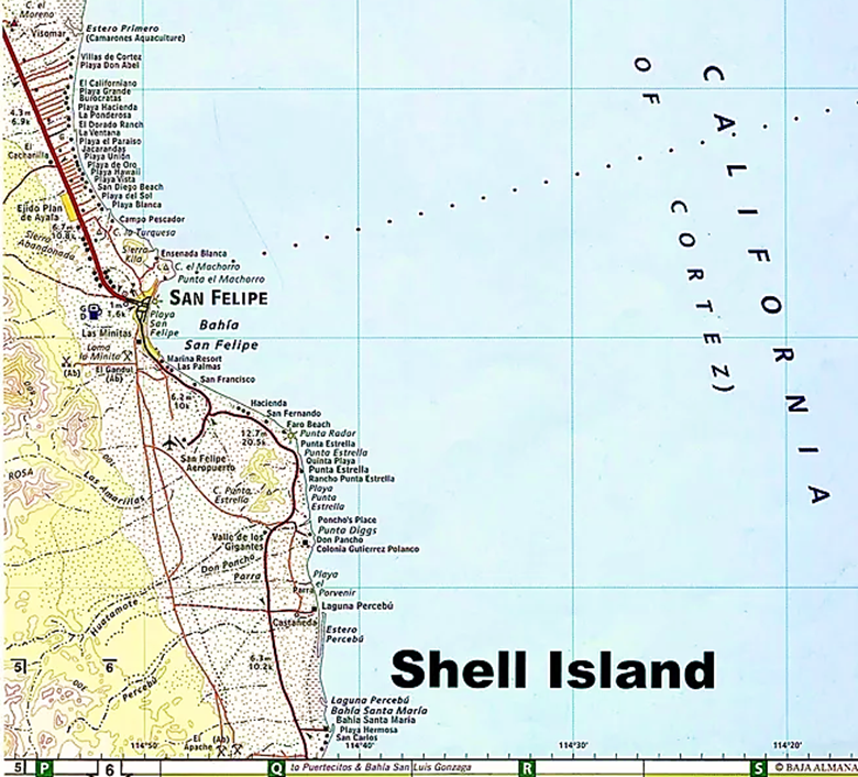
Our first night beach camp, on Shell Island (20 miles south of San Felipe).
>

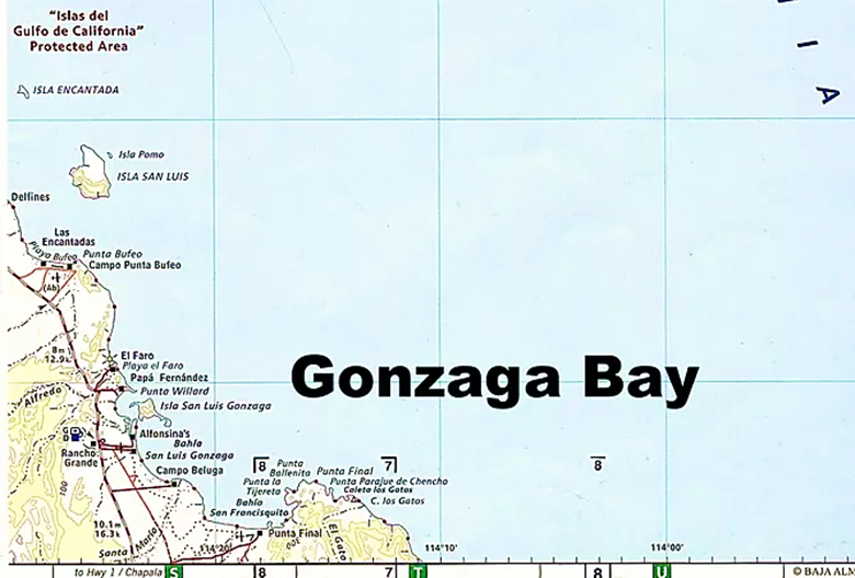
A photo stop at Rancho Grande, Gonzaga Bay.
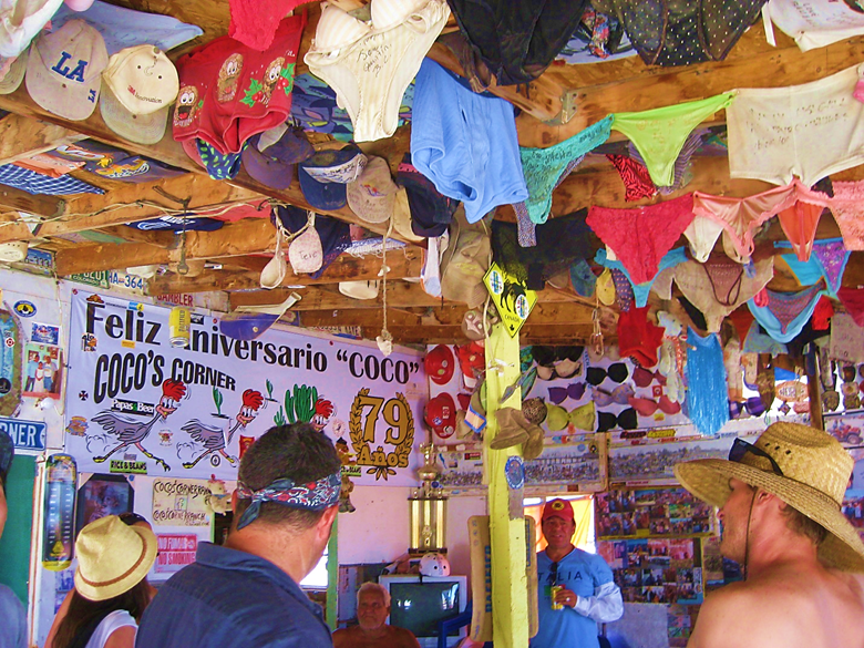
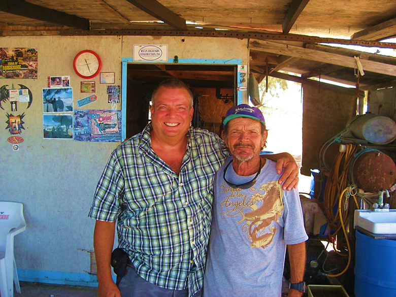
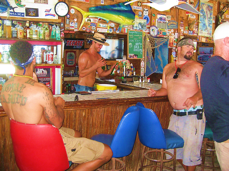
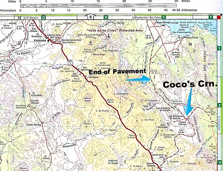
Everyone wanted to meet the famous Coco, at his Corner!
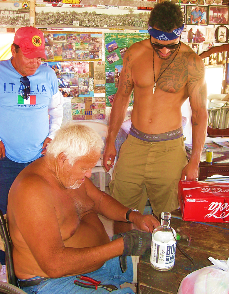
Coco makes a hook to hang a bottle of Channing Tatum’s Born & Bred Vodka, presented by Marland Burke. Marland is an actor and was in a film with Channing.
Underwear is the typical ceiling decorations here. Coco passed away, six years later, in August 2022.
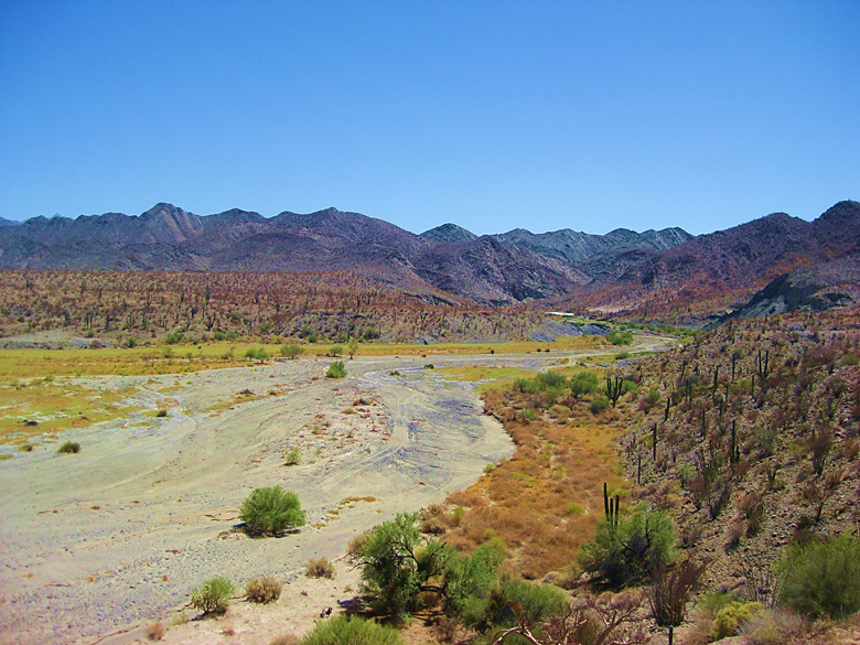
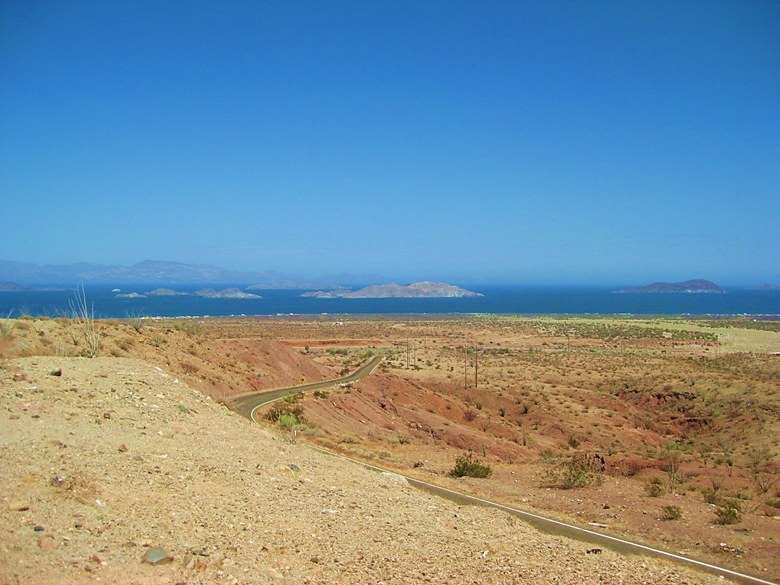
Arroyo Calamajué, across from the 1766 mission site.
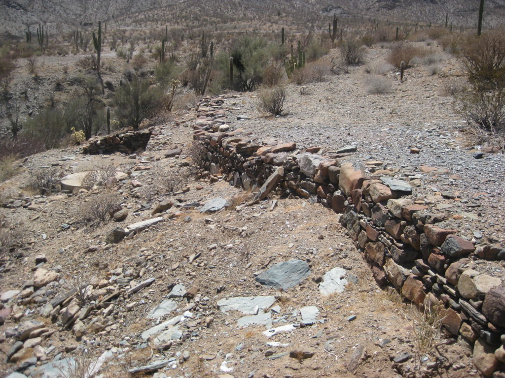
Remains from the Calamajué gold ore mill of the early 1900s.
Dropping down into the arroyo at Calamajué.
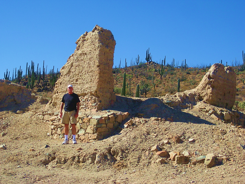
The 1766 Calamajué mission church outline. In the distance, see the road we just driove down.
In this 1957 photo from Howard Gulick, more of the mission was visible. Old gold mill is across arroyo.
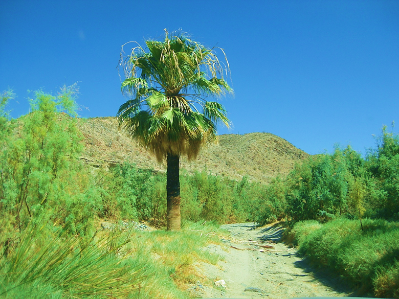
A few miles of driving in the year-round running stream before passing this palm.
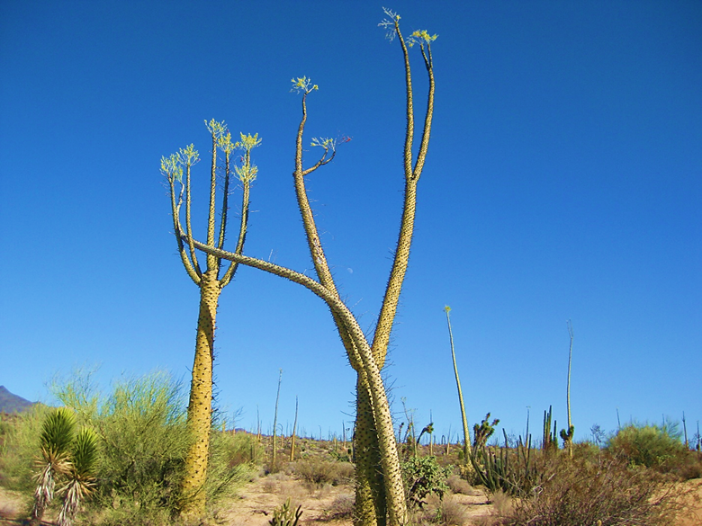
The Cirio or ‘Boojum tree’ is my favorite Baja plant. This pair are south of Calamajué Canyon.
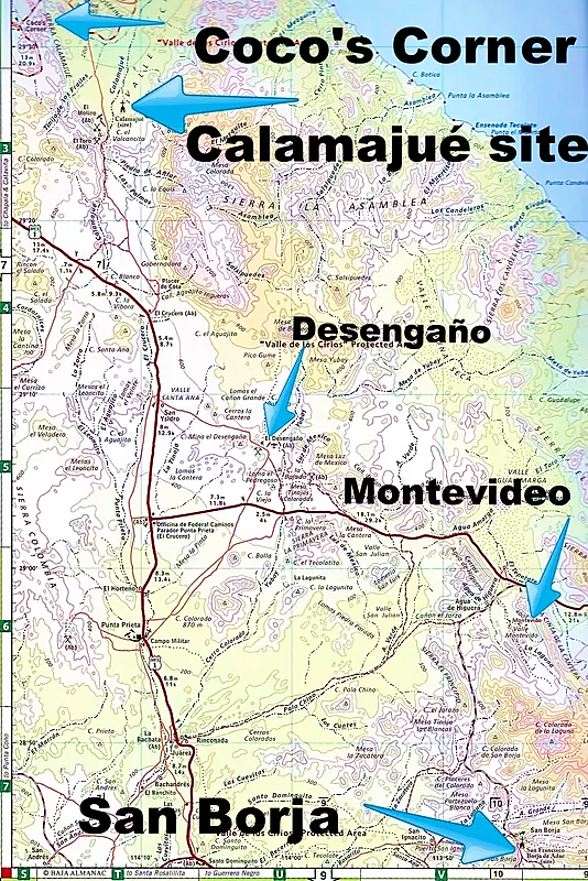
The 1801 church at Mission San Borja is the furthest-north Baja California cut-stone mission. José and his family maintain camping palapas with showers and flush toilets. Night two is spent here.
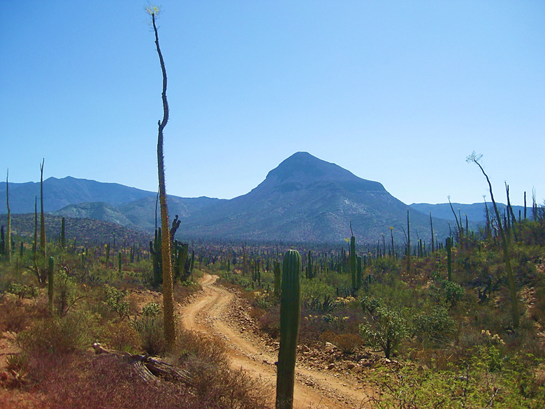
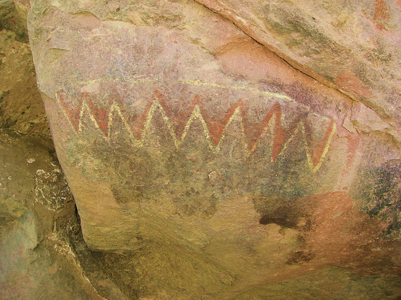
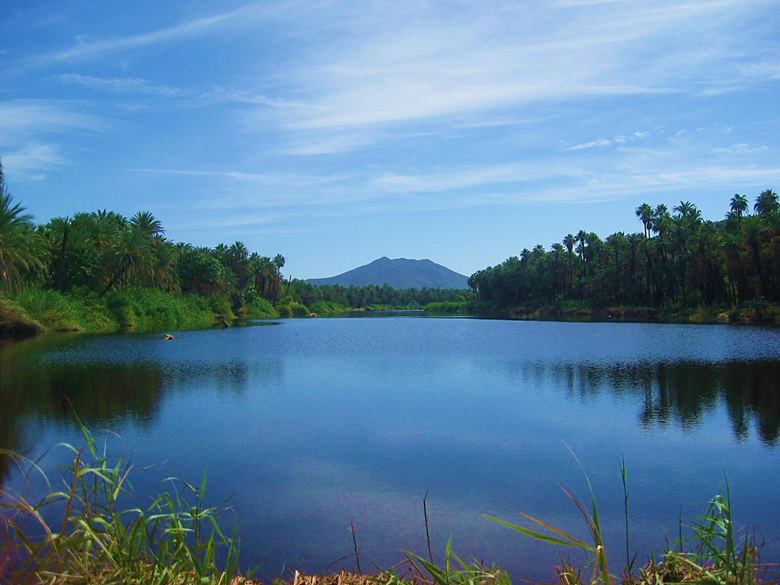
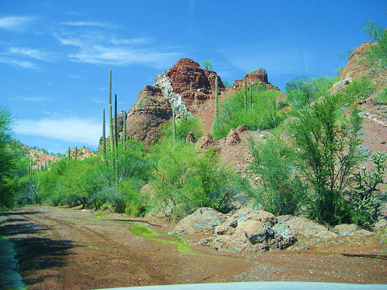
The road to San Borja is one of the most photogenic in Baja California and includes this volcano. We take a sideroad to see Montevideo, a painted cliff site
You can see the art from your car, it is that easy to get to. There is not one bit of modern graffiti added. Respecting historic sites this way preserves them for future generations.
The Montevideo painted cliff is so interesting. I have visited many times since 2001. A locked gate has stopped that, added in 2018.
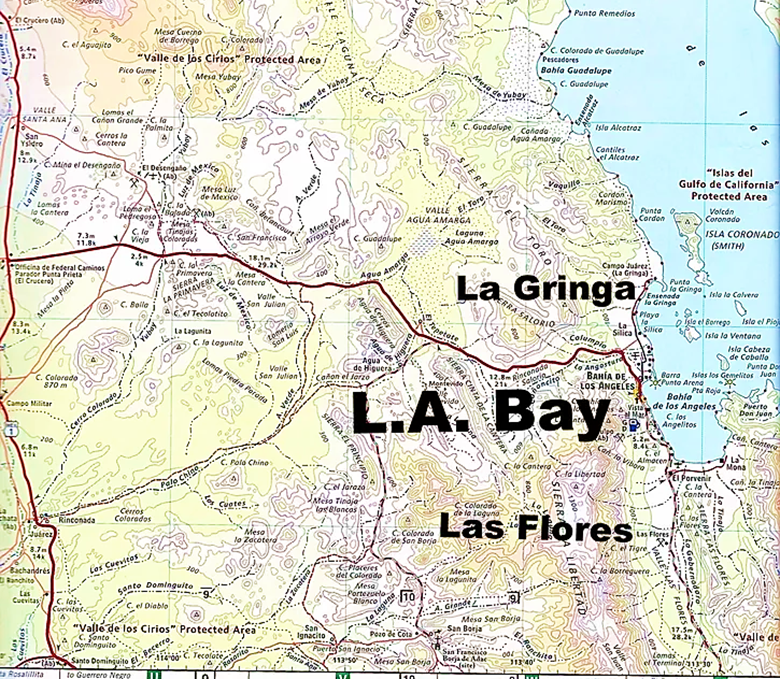
Our next overnight stop is Bahía de los Angeles.
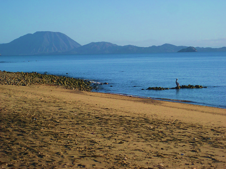
In the morning, a look at the volcano on Smith Island from Campo Archelon.
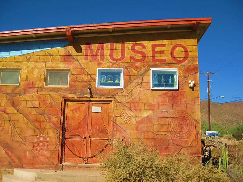
The museum in L.A. Bay is a must-see if you can. Many displays outside are from the area’s mining period.
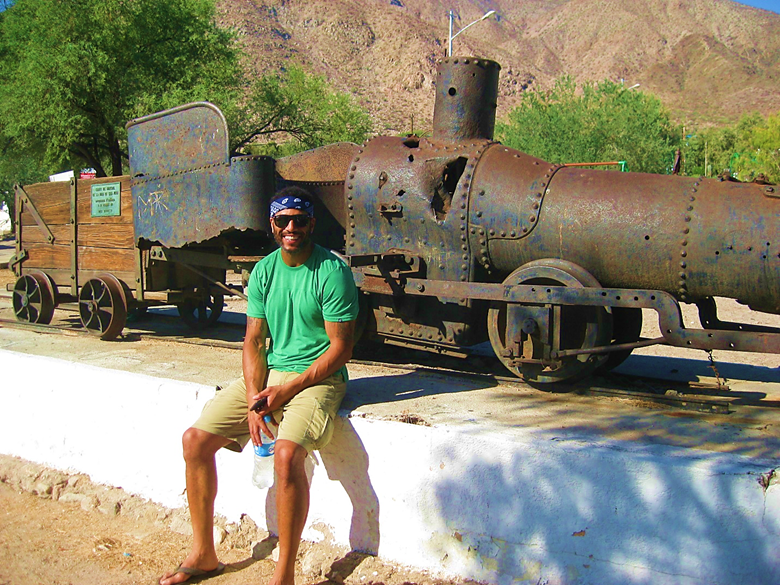
Marland posses in front of the Las Flores-San Juan Mine train engine, moved here from 10 miles south.
Leaving Bahía de los Angeles, southbound to San Ignacio for Night 4.
A stop to visit with Pancho has always been a must at Bahía San Rafael. [Pancho died in May 2018]
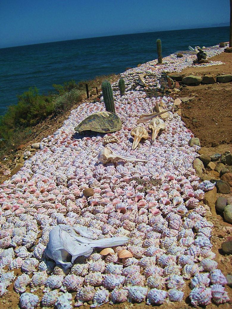
Pancho’s yard decorations. He always had gifts for the children and ladies.
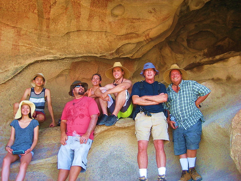
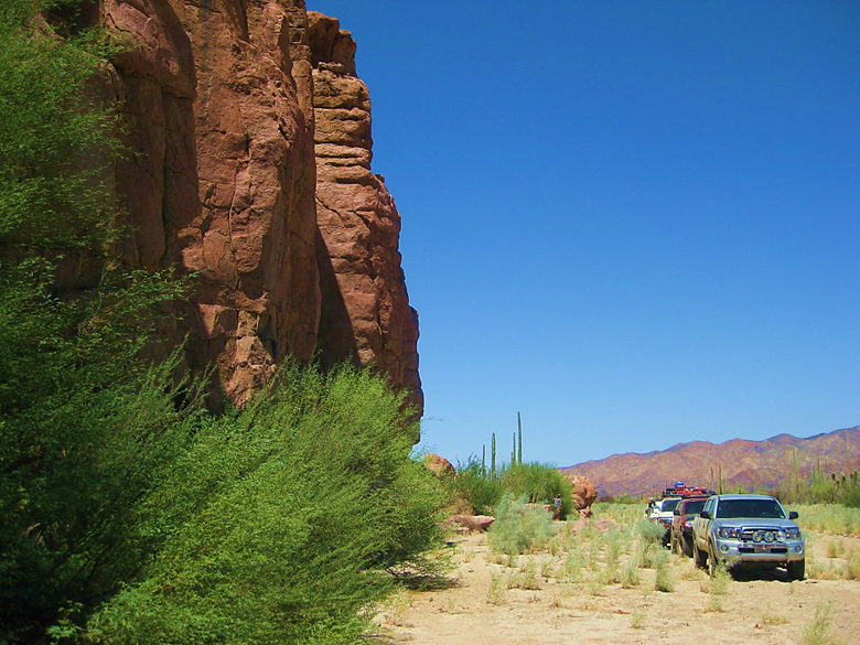
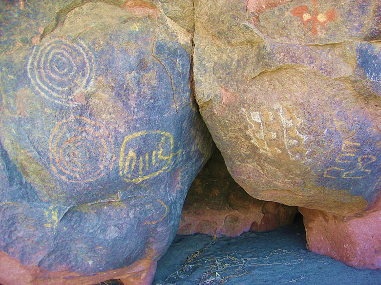
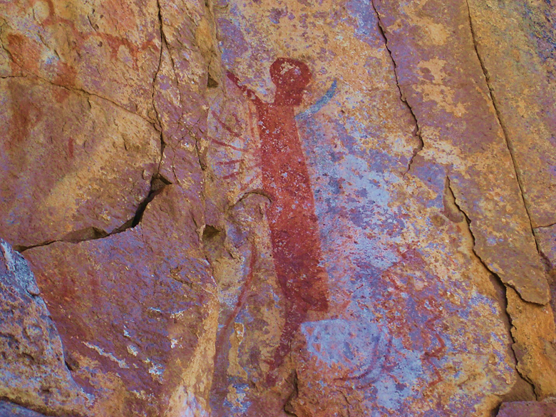
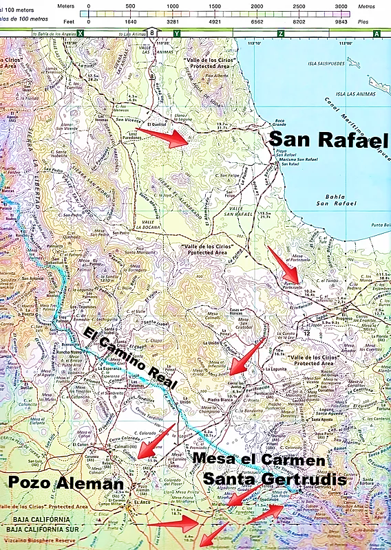
Marland took this photo of us at the Mesa de Carmen painted cave.
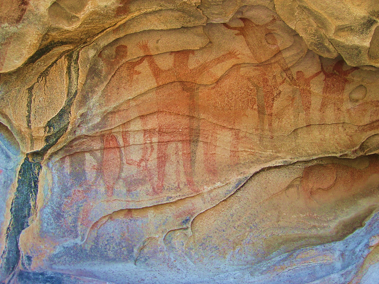
Our Toyotas, as seen from the painted cave.
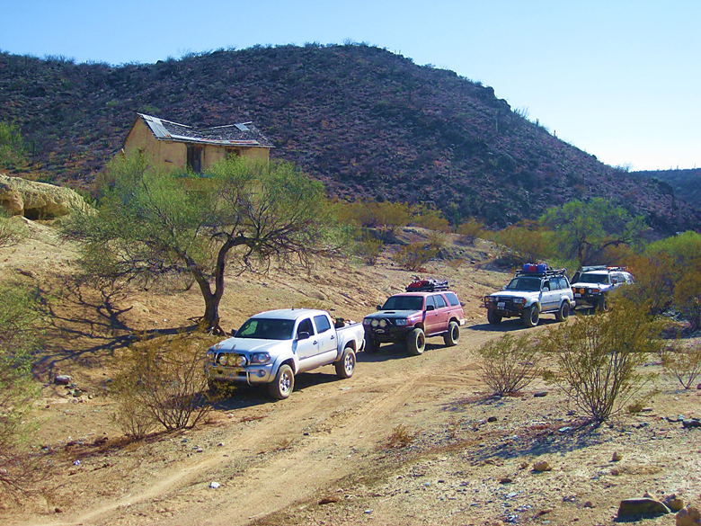
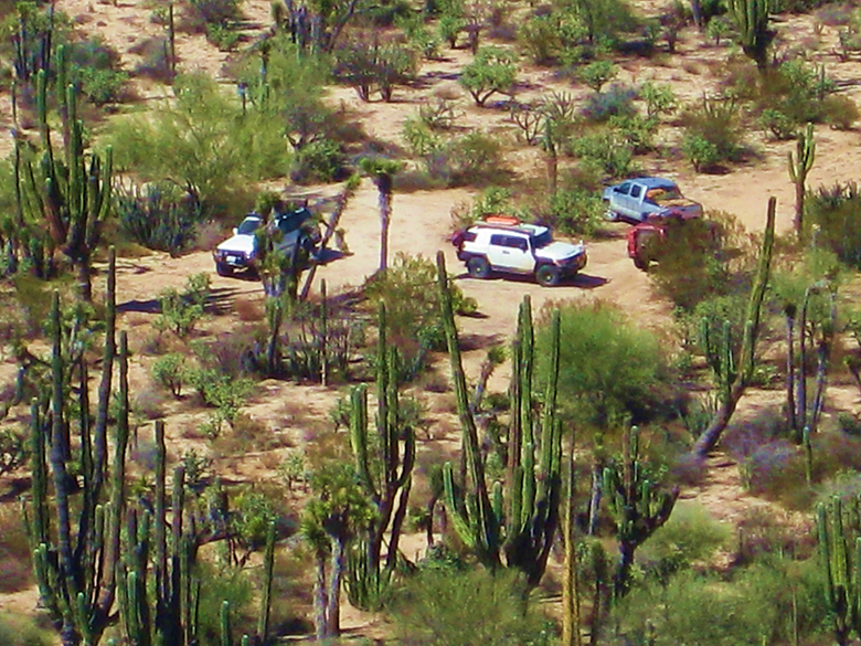
Pozo Alemán was our next stop. A gold mine ghost-town from the 1910s.
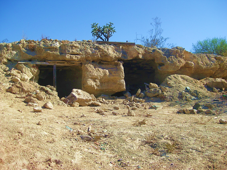
Some miners lived underground to escape the heat.
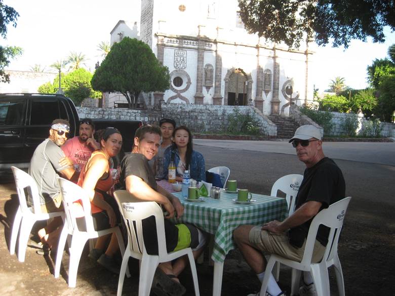
Breakfast at Victor’s in San Ignacio.
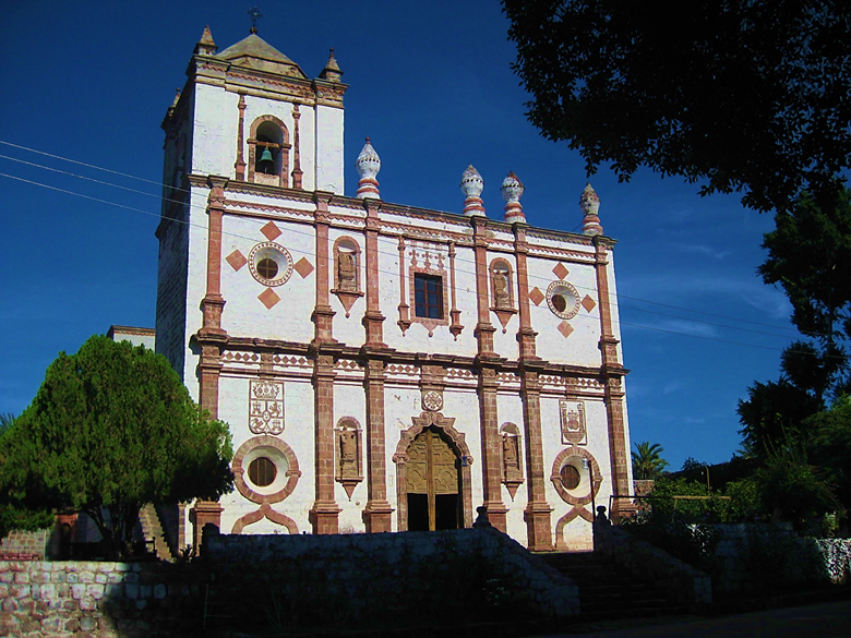
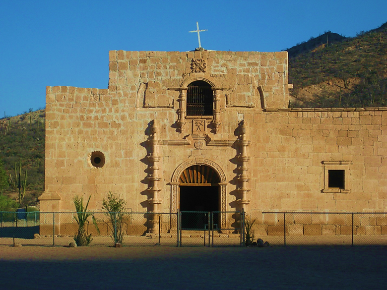
Mission San Ignacio, founded in 1728, and this cut-stone church was built between 1761 and 1786.
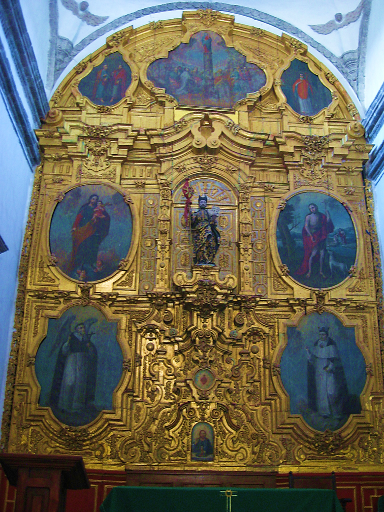
The gold covered altar retablo and original paintings are stunning.
Leaving the oasis of San Ignacio to continue to our next ‘gem in the desert’.
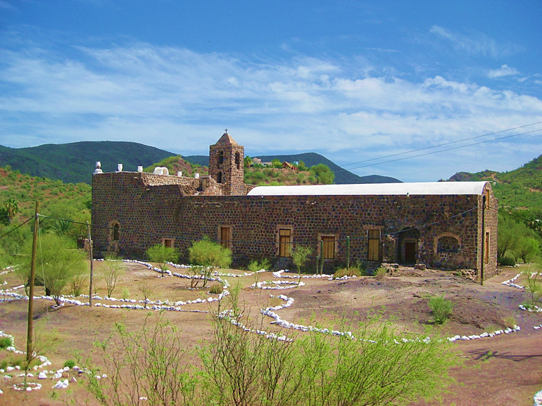
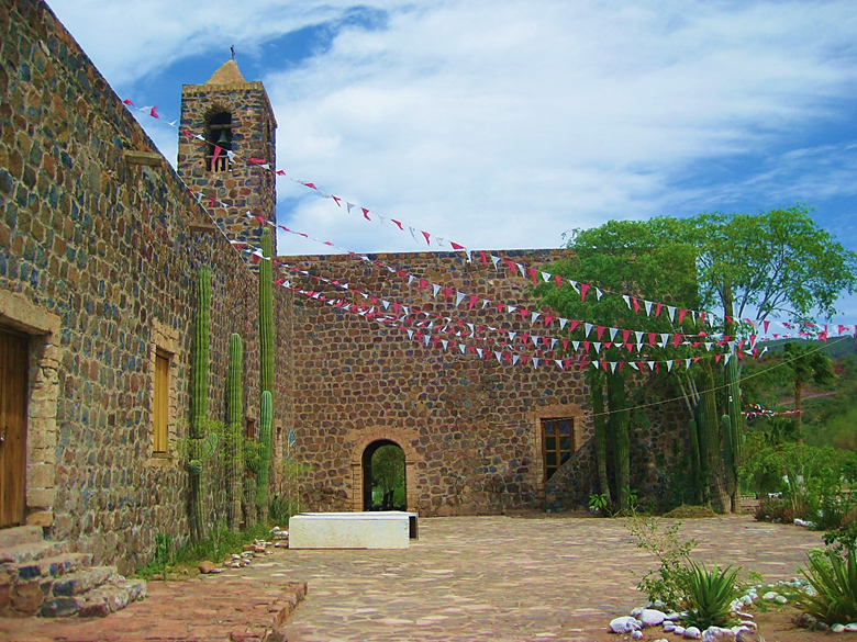
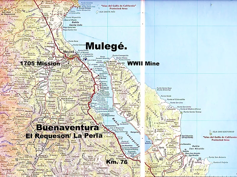
The mission at Mulegé was founded in 1705. This stone church was built from 1757 to 1766.
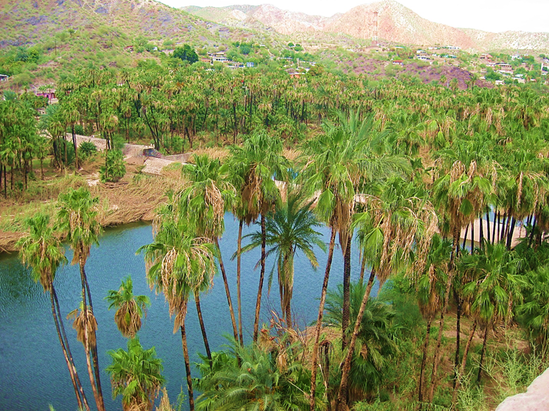
The oasis at Mulegé, as seen from the mission site. The U.S. Navy landed troops here during the Mexican War of 1846-1848. The local militia repelled the gringos making Mulegé a heroic town. Read more in my article: HERE
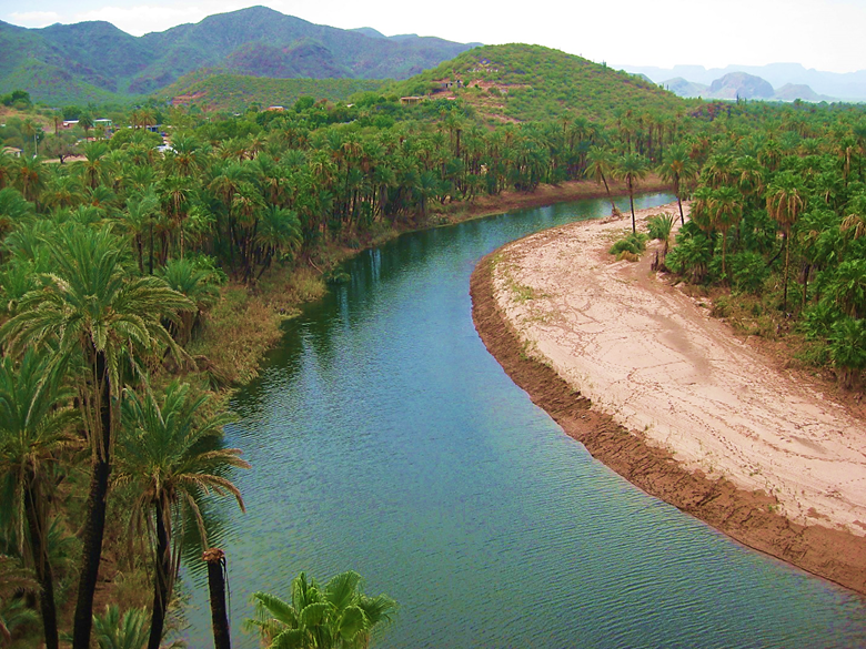
One of the rare Baja California rivers, in Mulegé.
At Playa Buenaventura (Km. 93), cantina hosts Mark, Olivia and Nathan treat you right! *In November 2024, the ejido ended the lease and demolished this popular restaurant/ cantina with a bulldozer.
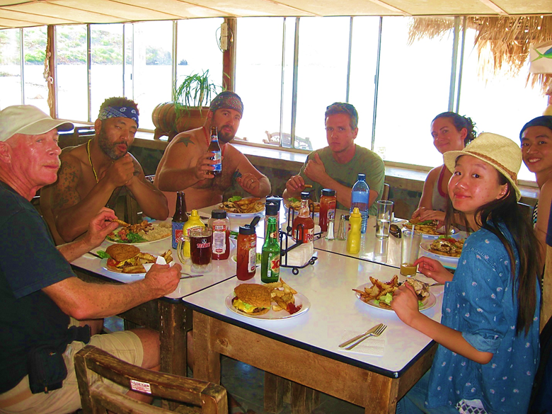
Cheeseburgers in paradise is not just a Jimmy Buffet song, at Playa Buenaventura on Concepción Bay! They want to do some serious off-roading and asked to include going up the peninsula on the other side of the bay to a manganese mine, from World War II. A tropical storm was just through here a week before and sure enough, the road was gone. We would discover that after several miles and hours driving at night! Night 5 was not in the best place, but we did okay.
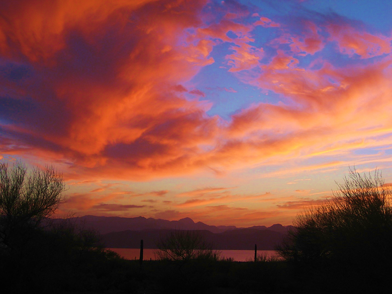
Sundown from the other side of the bay.
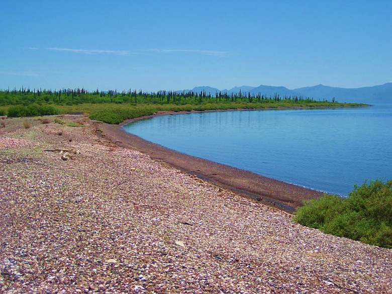
The next morning was gorgeous. I would later discover that Erle Stanley Gardner took a photo at this spot when he explored over here on the peninsula in 1966.
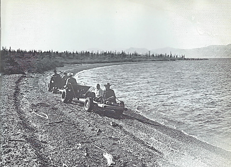
Erle Stanley Gardner, using funds from his TV series Perry Mason, loved to explore Baja using custom made ATVs. This photo is in his 1967 book, Off the Beaten Track in Baja.
We did drive up a canyon in this lovely stream. At the end, the water flowed out of solid rock!
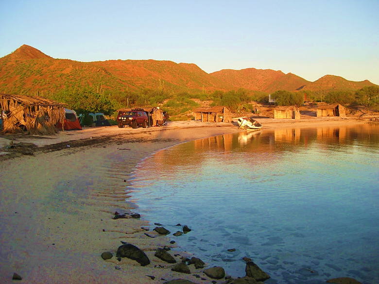
We go back to the ‘popular side’ of the bay and camp at La Perla for Night 6. Morning shot here.
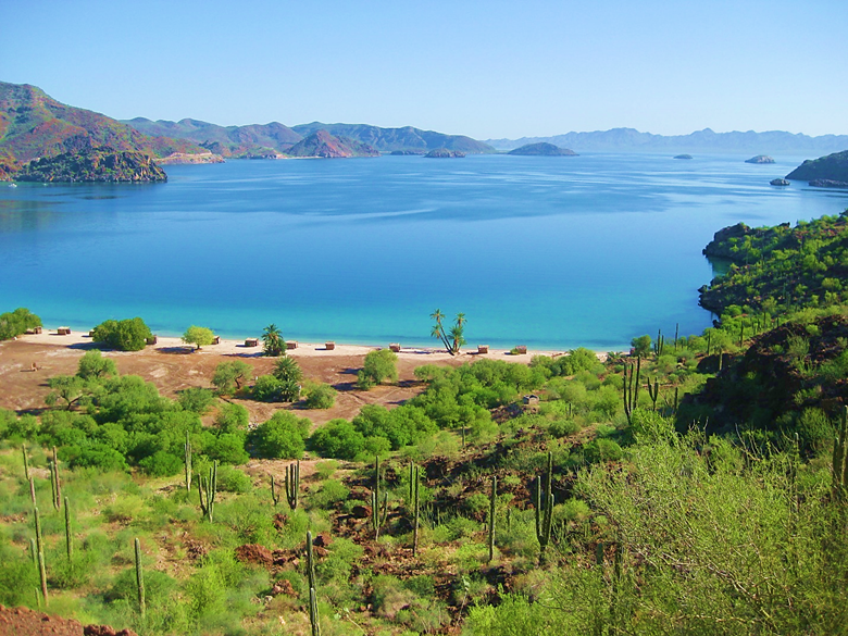
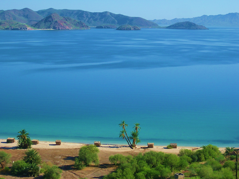
Photos of Bahía Concepción are always great. This view is on many book covers, in fact.
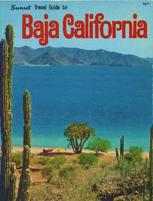
Published in 1971
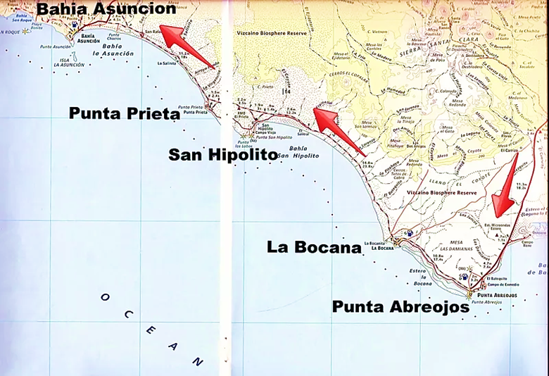
We cross to the Pacific side of Baja at Bahía Asunción and stay two nights at the Bufadora Inn. www.bahiaasuncion.com
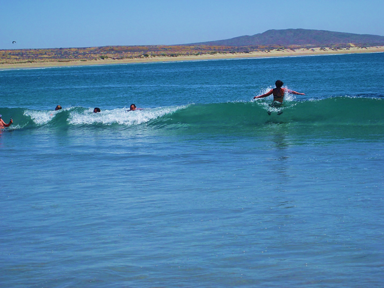
Body surfing in the calm little waves at nearby San Roque.
A little group R&R at San Roque.
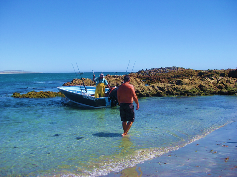
A fisherman just arrived so Jesse and I have a look at the catch, and I buy one of the yellowtail caught. We will have some fresh sashimi tonight!
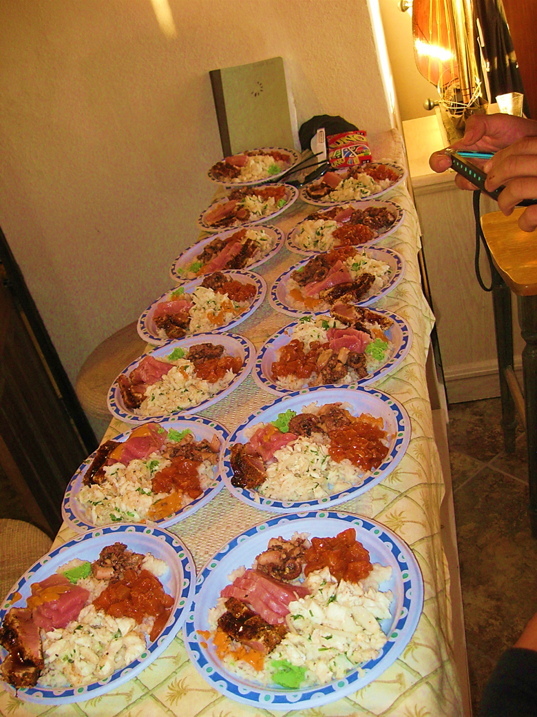
Chef Jesse, using the yellowtail and other fresh seafood from Bahía Asunción made an amazing meal!
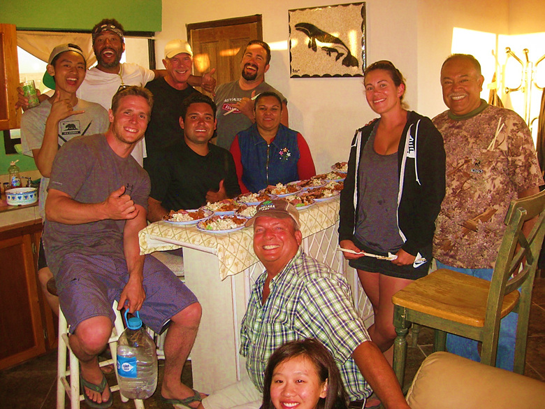
Three locals joined us and host Shari Bondy for the feast. Photo by Shari Bondy.
We get ready to leave Bahía Asunción to head to northern Baja, more missions, more rock art, and more good food!
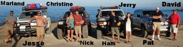
With our Land Cruiser, 4Runner, FJ Cruiser, and Tacoma. Photo taken by Shari Bondy.
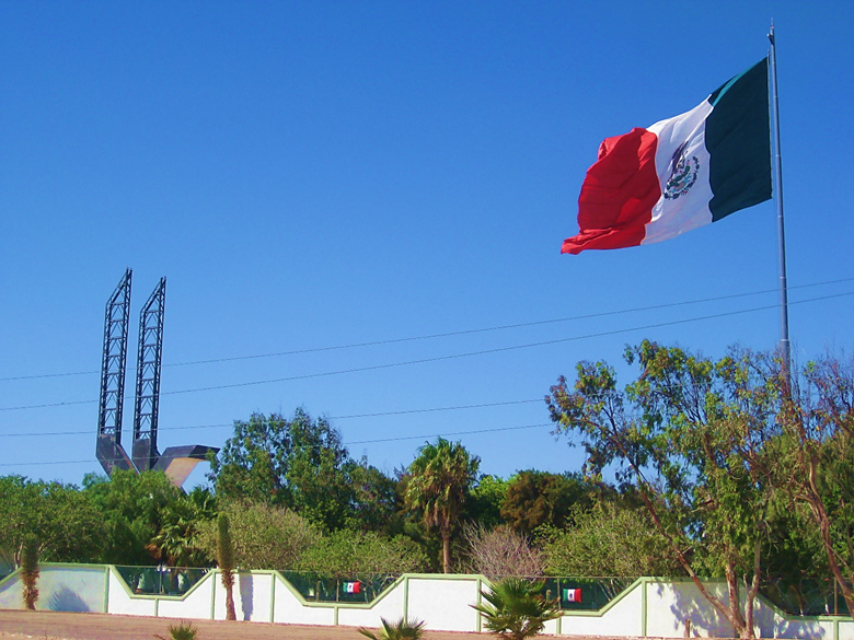
A giant eagle and giant flag are passed as we enter the state of Baja California from Baja California Sur.
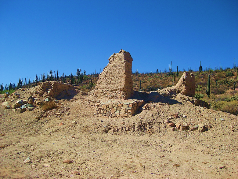
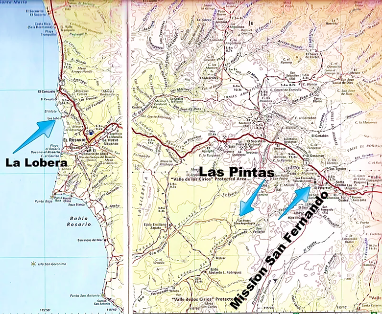
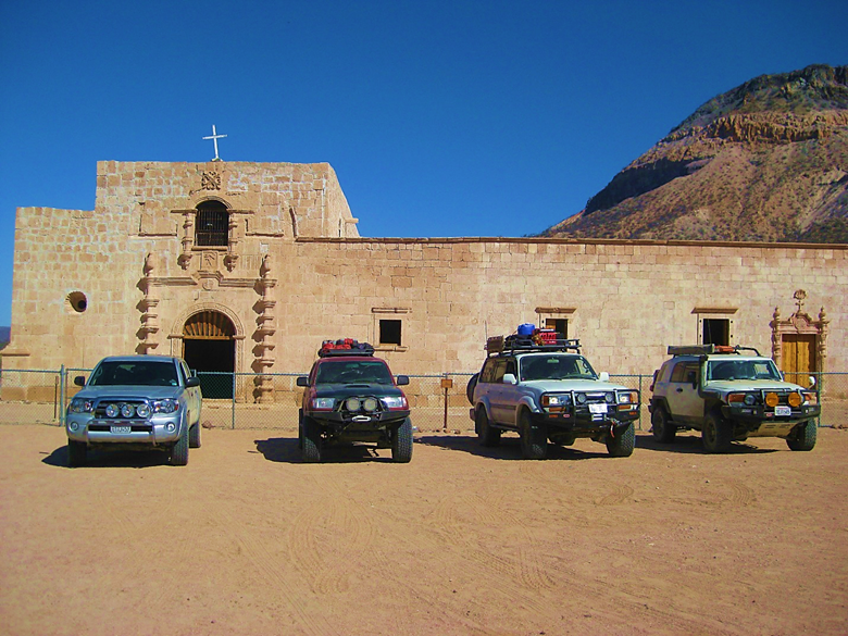
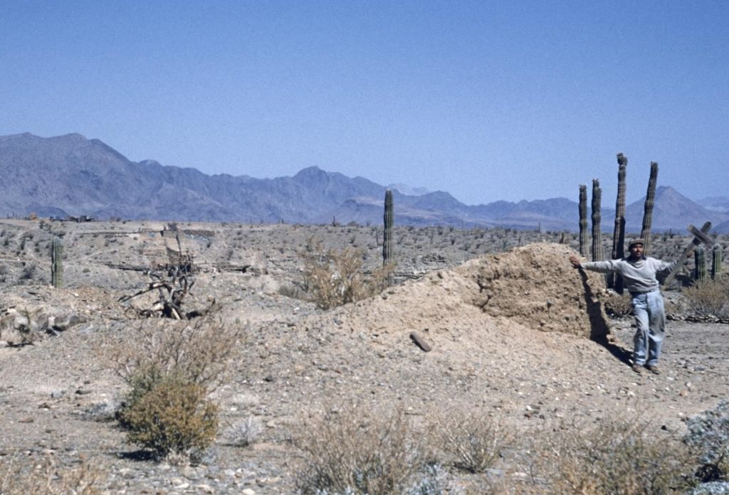
The mission of San Fernando de Velicatá was founded in 1769 by Junípero Serra on his expedition to San Diego from Loreto. Made of adobe, the weather and foolish treasure hunters have all but destroyed this, the first California mission founded by a man who would become a saint almost 250 years after.
Pat Malone wanted to see as many missions as we could. He recorded much of our trip on his video camera and they are saved on YouTube. Links below. Ham Jam, driving the FJ Cruiser also recorded our trip and made a really fun video, as well.
Marland and Pat coming back from location shooting on the road to Las Pintas.
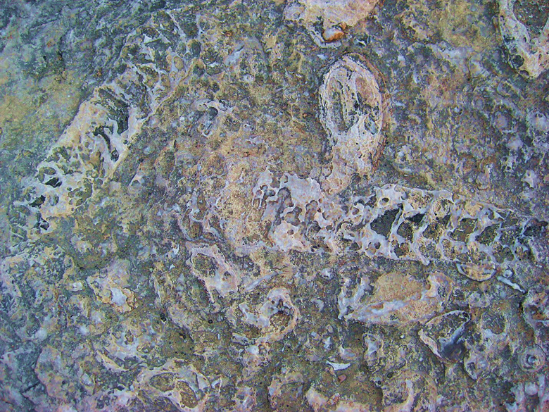
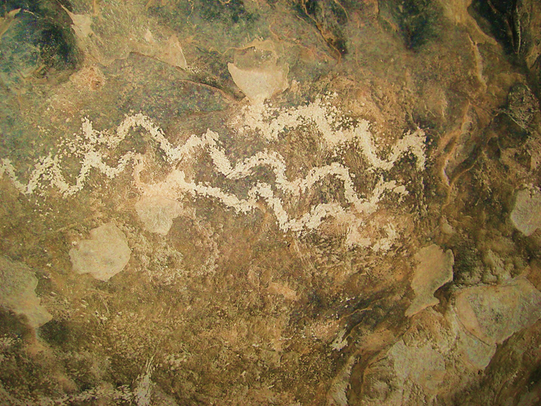
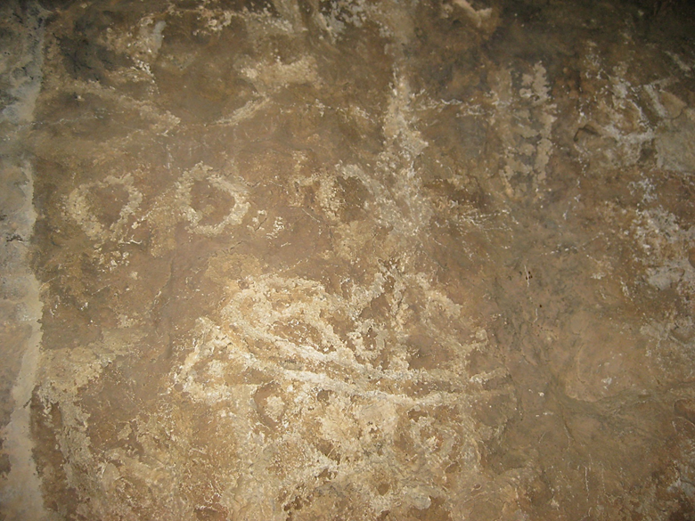
Las Pintas is a fossil grotto that is also covered in petroglyphs.
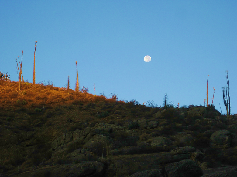
Moonrise above the boojum trees at Las Pintas, Night #9.
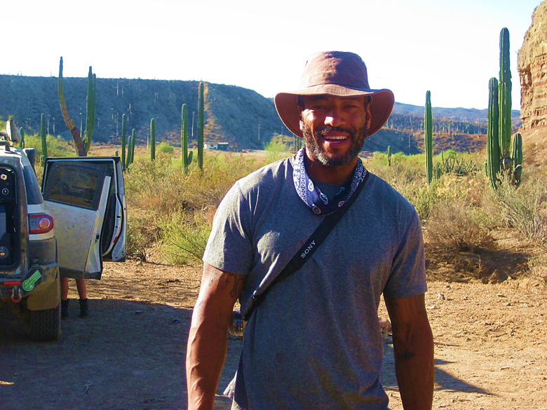
Hollywood actor, Marland Burke enjoying the Baja Feeling at Las Pintas!
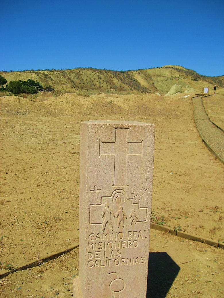
We make a quick stop at the 1774 mission of El Rosario, along El Camino Real, the mission trail.
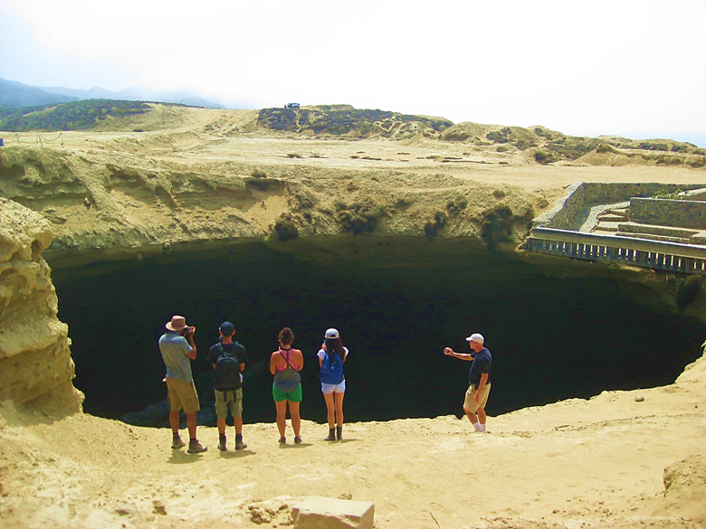
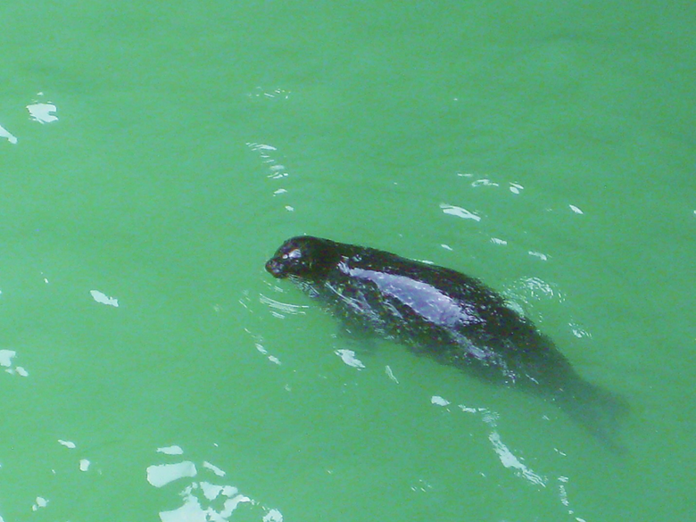
La Lobera, the sea lion crater is our next stop.
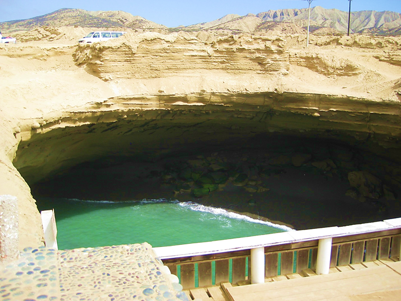
The ocean and sea lions enter through a cave.
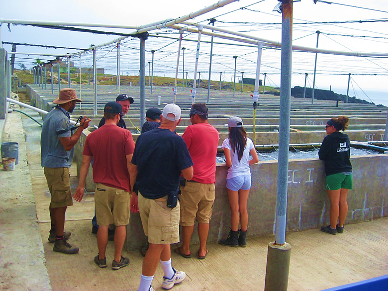
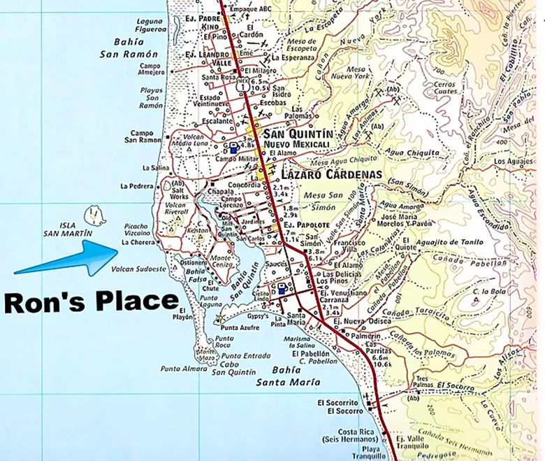
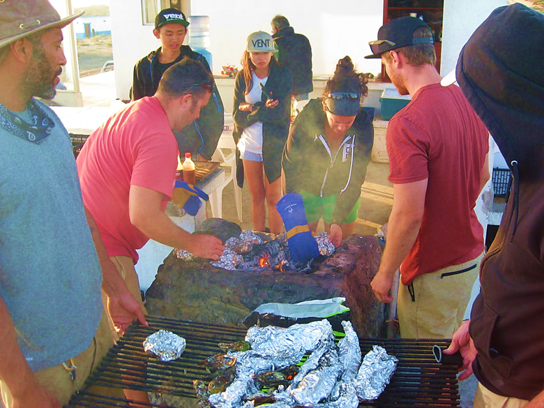
Our final stop and overnight is at Ron Hoff’s sea-culture farm where we enjoy a tour and sampling fresh oysters from nearby San Quintín Bay.
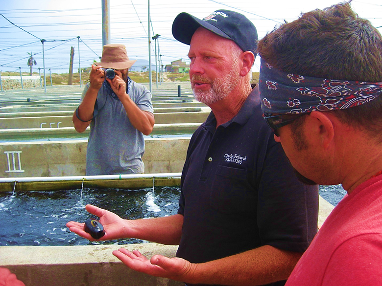
Ron tells us that limpets may hold the cure for cancer and other health benefits.
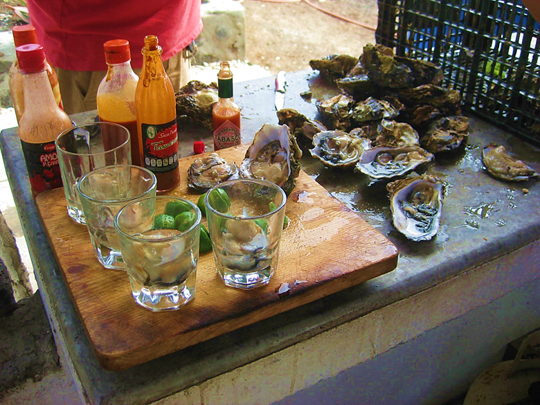
The freshest oysters one could enjoy, raw, and cooked that day!
Day 10 of our tour was great, and fun for me too, it was my birthday! Ron had a surprise for me, and the group was all behind it, too
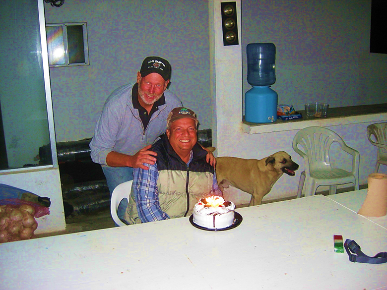
Thank you, Ron and the Baja Extreme 2016 Tour Members! The next day we returned to the United States and this great tour concluded. To help plan your Baja Extreme tour, visit vivabaja.com Enjoy this fun video by Ham Jam that condenses the eleven days down to under seven minutes: https://www.youtube.com/watch?v=kAWGzW4bR9Q
My passenger, Pat Malone made the following videos of our tour:
#1: San Felipe-San Borja: https://www.youtube.com/watch?v=CP8cR3TC3rM
#2: San Borja-Mulegé: https://www.youtube.com/watch?v=3Xo5al5-H-c
#3: Punta Concepción: https://www.youtube.com/watch?v=QlGjIqNFVRk
#4: San Ignacio: https://www.youtube.com/watch?v=pr3c_RsNmDs
#5: Boogie Board (San Roque, Bahía Asunción): https://www.youtube.com/watch?v=Aw8KEt01Ydo
#6: Yellowtail (San Roque, Bahía Asunción): https://www.youtube.com/watch?v=L80Xei0DktY
#7: Las Pintas, Mission San Fernando, La Lobera, San Quintín Oysters): https://youtu.be/pu8OZyy5S9U
MAPS featuring places visited:
[Desengaño was not visited]
[Santa Gertrudis was not visited]
[The WWII Mine was not visited]