Amigos de Baja: Jim & Linda (‘fishuntr’), Ross & Rose (‘chicagoross’) and David K & daughter Sarah first attempt the ‘toughest road in Baja’ to explore the Mision Santa Maria region. After two days, we continue south to L.A. Bay and continue a great Baja trip. The following photos are from the camera of ‘chicagoross’ or David K, unless otherwise noted.
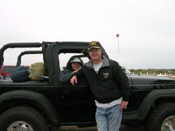
Rose and Ross at Gypsy’s, San Quintin. We all meet up here Friday, April 11, 2003.
Mission San Fernando de Velicatá
We stop at the mission that followed Santa Maria, on the El Camino Real to Alta California.
Petroglyph Cliff West of Mission San Fernando
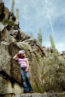
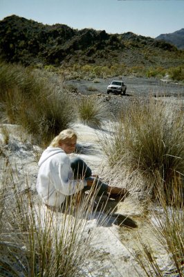
Sarah K
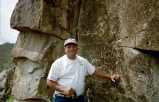
David K
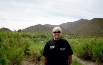
Linda
Oscar of Rancho Santa Ynez
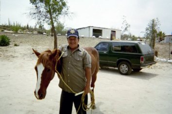

Oscar is showing us a trick he taught ‘Rayo’ (‘Lightning’).
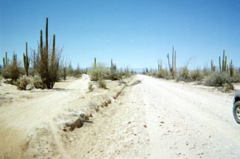
On our way to Santa Maria!
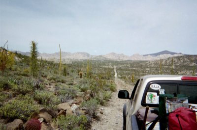
About two miles from Santa Ynez, the road is heading northeast. One deep arroyo crossing is just behind us.
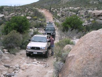
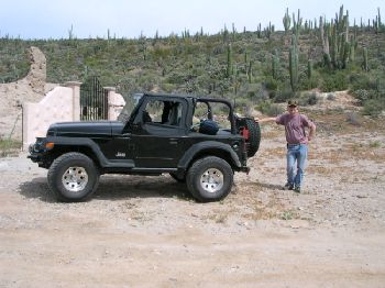
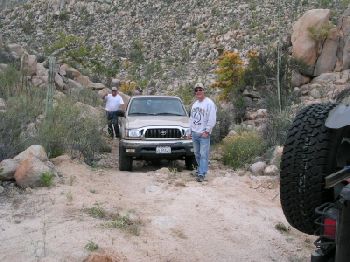
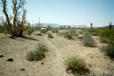
The caravan contained two Toyota trucks and a Jeep Wrangler.
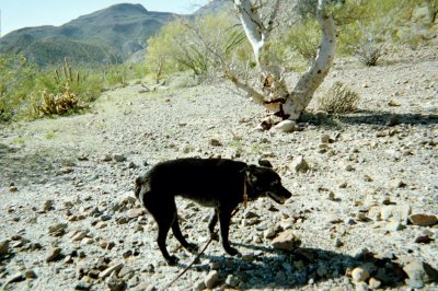
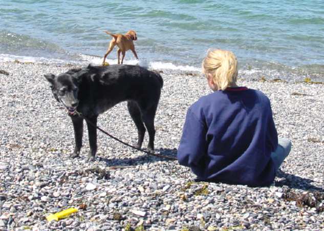
‘INKY’ The Mystery Dog
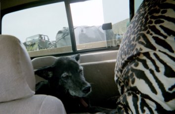
Eight miles east of Santa Ynez, this dog was alone next to the road. She had a name tag… We would learn her story upon our return home.
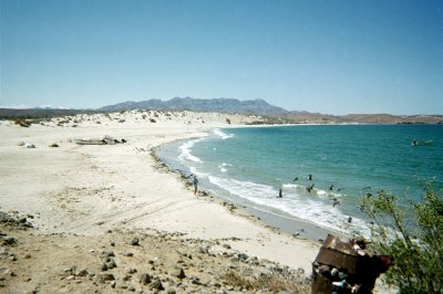
High Elevation Point, View of Gonzaga Bay
9.9 miles from Santa Ynez, the road reaches the top of the mountain (at 2,512′) and begins to drop towards the gulf.
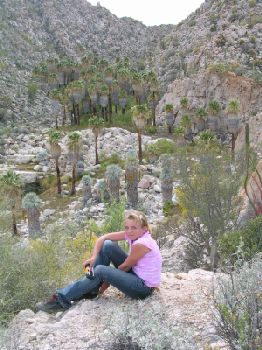
Sarah along the road to Santa Maria.
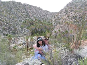
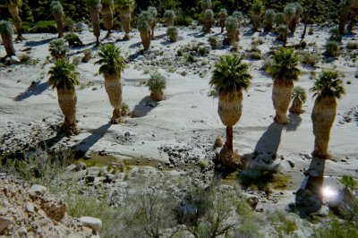
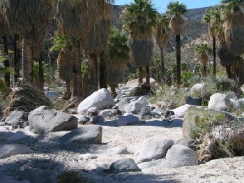
Here’s Rose and Ross, with the beautiful oasis behind.
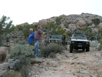
Fishuntr and chicagoross have a look…
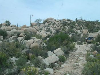
This is quite a wild road, in quite a wild land!
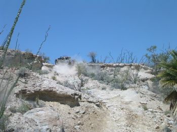
The Widowmaker!
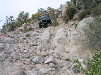
Coming down today was tough, but going back up in two days, was scary! The Jeep had no problem! The top is 13.3 mi. from Santa Ynez, at 29°44.75′, -114°33.19′ (WGS84) elev. 1,748′.
Fishuntr drops down the widowmaker!
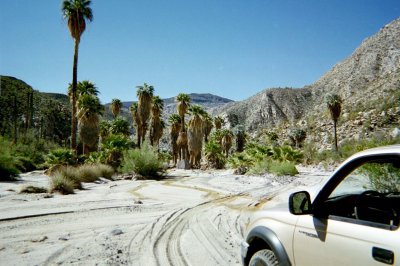
Mision Santa Maria is reached…

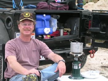
It must be Miller (or Pacifico) time! After the longest 14.5 miles in Baja (2 hrs. 30 min.) it is well deserved.
Santa Maria de los Angeles 1767-1769
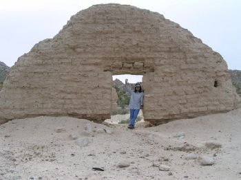
The adobe church was built by the Franciscans after the Jesuits were expelled from California. They soon closed Santa Maria once San Fernando was established. Supplies were brought up from Gonzaga Bay and Santa Maria continued as a resting spot on the old mission trail. GPS (WGS84) 29°43.90′, -114°32.83′ elev. 1,651′.
Unless the recent doorway erosion is repaired, this entire wall may soon collapse. Additional mission photos and details at http://vivabaja.com/missions1/
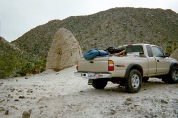
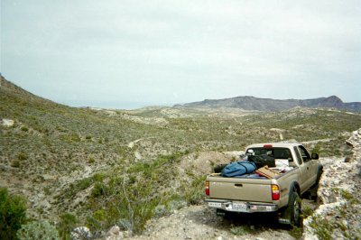
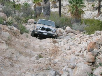
This was worth it… knowing my pure stock Tacoma TRD truck could get to the mission! The really hard part… is getting out!
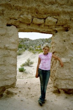
Sarah at the mission’s doorway, 4-12-03. I hope it is still standing for years to come.
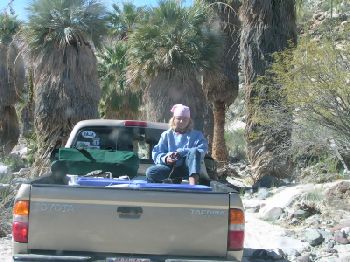
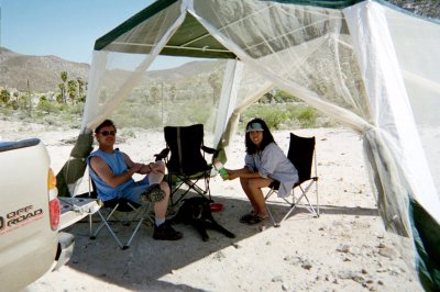
Ross knows how to camp lite! The Jeep Wrangler sure is good on tiny Baja roads, but very little space for ‘luxuries’ is available.
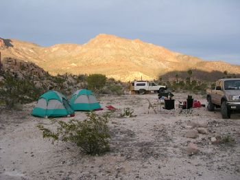
The setting sun illuminates a distant ridge. Our camp is set up for the next two nights.

Sunday morning we awoke to a beautiful, blue sky. It just doesn’t get any better than this!
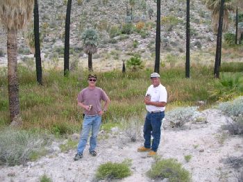
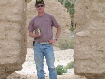
Ross and David have a look around the mission before we explore the rest of the valley.
Such a beautiful sight makes any road worth the drive. Photo by ‘fishuntr’
About a half mile east of the mission, this is the view.
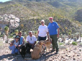
Rose, Ross, Inky, David, Linda, Jim, and the labs.
Inky in the Mission Santa Maria valley, 4-13-03.
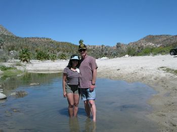
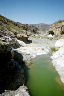
We find a nice beach and pond, where the road rejoins the arroyo, east of the mission.
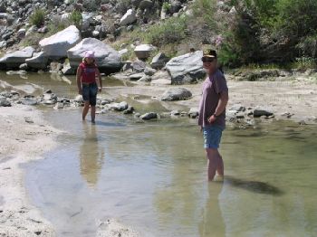
Sarah is tadpole hunting, Ross is cooling his toes.
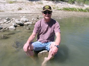
Happy Ross finds a seat!
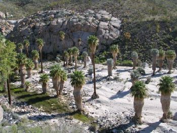
Another Baja oasis in the desert… You just got to love it!
Inky and Sarah ride in back, after playing in the water! We continue east and find the tracks end at this oasis. A short distance back were some tracks going north at 29°43.17′, -114°31.91′, and that was the the road (1.3 mi. from the mission)!
The Santa Maria river heads to a waterfall in the canyon leading to Gonzaga Bay. The constructed road goes up the north side of the valley.
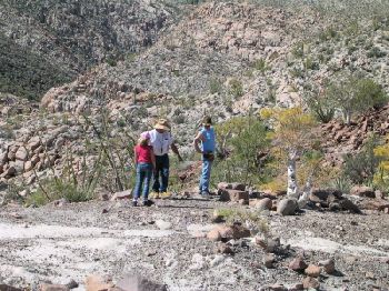
We are able to drive only a quarter mile from the arroyo, then hike to the top of the bulldozed grade. This is where the Indian trail continues east, and drops down the canyon. Petroglyphs decorate several rocks here. 29°43.04′, -114°31.60′ elev. 1,615′.
Petroglyphs on the Indian trail

The deep Santa Maria canyon is in the background.
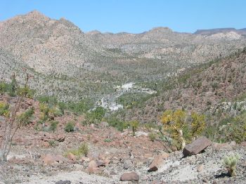
Looking back west towards the mission. An aerial photo of this spot is at http://vivabaja.com/missionsm/
There are few level sections of road in the area! After hiking back down from the ridge, we needed to turn around where the road became impassable.
Returning to the mission, is one steep grade to climb!
While I am off searching for the El Camino Real, Ross sets up my screen house. Even with all the people and dogs, we had a visitor…
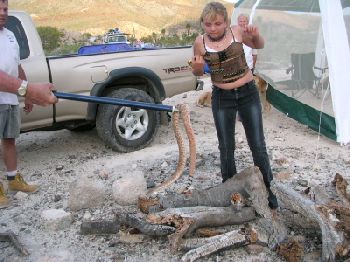
This Red Diamondback Rattlesnake was not afraid of us, having just slithered through the screen house.

The snake was where Linda is standing, when I spotted it, near my feet! Because the dogs and people didn’t keep it away, it was too dangerous to leave alone, so far from medical assistance.
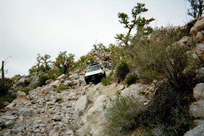
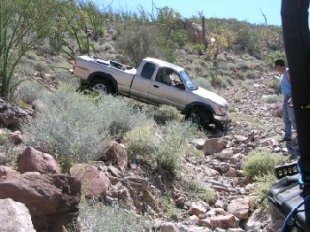
Climbing Up the Widowmaker!
This was the toughest part of the route. Even with a locked rear differential, my progress was stopped by a foot tall rock face. Adding some rocks in front to make a ramp, and Ross’ directions for tire placement, allowed me to reach the top.
Reached the Top!
It was a bit scary, but having a good Baja amigo along made it happen. A small parking place is here and the mission is only 1.2 miles away, if you prefer to walk and not take the challenge.
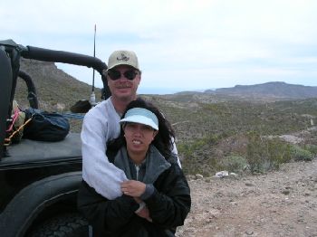
Ross and Rose on the peninsular divide, Gonzaga Bay’s Punta Final is viewed from here. This was a great trip… Ross and Rose head home this day. Jimmy and Linda continue south with Sarah and I. The second half of our Spring Break in Baja follows… Our next camp was at Bahia de Los Angeles with Jimmy and Linda. Ross and Rose had to return home after Santa Maria. We stayed at Camp Gecko, next to 4Baja’s (Steve’s) lot. Short trips to La Gringa, the copper mine, and Las Flores occurred the next couple days.
Camp Gecko (next to 4Baja’s place)
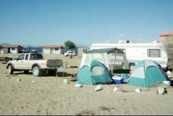
Spring Break is busy at Gecko, good amigos invite us to camp on their lot, next to 4Baja (Steve) .
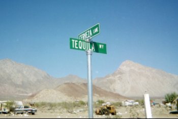
4Baja’s Street Address
INKY on April 15, 2003
Inky is kept secure by Sarah at La Gringa, Bahia de L.A. while Bedman & Emma’s dog Daisy checks the water. She ran away that evening, scared by fireworks. (photo by Bedman)
Las Flores Railroad

Operated over 100 years ago, this narrow gauge train brought gold and silver ore from the cable tram to the town of Las Flores, 5 miles away. Photo at the south terminal.
Rattlesnake #2
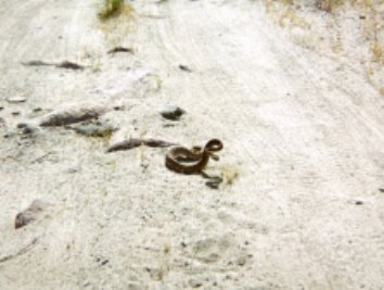
On Wednesday (4-16), Sonora Wind & Jay join Fishuntr, Linda, Sarah & I on a drive to Mission San Borja. This Baja Ca. rattler was near the Montevideo pictographs. No harm came to it.
Lost Mission Hunt IV
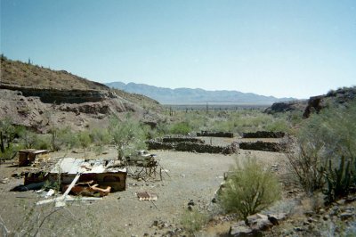
On Friday (4-18), using an old photo of the ruins I hope to ‘re-find’, we drive south on the old road . This is Jesus Flores’ former ranch, Los Paredones at 28°36.71′, -113°24.86′’. Nobody’s home!
Rancho La Bocana Gym

Located just inside San Pedro canyon at 28°28.40′, -113°23.66′. This creative Baja bench press was behind the empty La Bocana ranch house (misnamed ‘San Pedro’, in the Almanac).
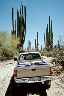
Heading east in the La Bocana Valley, famous for giant cardón cactus.
Old and New Roads Meet
This is looking north, the old and new L.A. Bay to San Francisquito road junction at 28°26.06′, -113°10.45′, south of Bahia San Rafael.
Bahia San Rafael
The view from Pancho’s home. Cold Pacifico beer and a friendly greeting awaits you here!
Rattlesnake #3

It must have been the heavy rains this year? In all my life of Baja travel, I have seen just two rattlers. In this one week, I saw three! This big fellow was on the road south of Las Flores. He (as well as the last one) wasn’t harmed. Sarah watches too much Steve Irwin, perhaps?
The El Camino Real…
…near where it crosses the L.A. Bay highway. I pulled off between Km. posts 30 & 29, to the north, on a dirt road. Just beyond where I parked, I found it. Above photo looking southeast. 29°2.01′, -113°52.86′ (WGS84).
On to El Volcán
Four miles northeast of the El Mármol onyx schoolhouse, the process by which onyx is made can be seen, at El Volcán. Several mineral springs where onyx is created (about an inch every thousand years) are in the arroyo and a quarter mile beyond. The biggest spring is on top of a thirty foot dome, which erupts once a month. This cold water geyser is how El Volcán (The Volcano) got its name. For several minutes water and gas is sprayed 60 feet into the sky!
Directions: Take the signed dirt road off Highway 1 for 9.5 miles to El Mármol’s onyx schoolhouse. Note sign pointing to the Mina La Olvidada road. At 2.0 miles from the schoolhouse, turn right, 4WD recommended from here. At 4.0 miles, come to Arroyo El Volcán. Onyx dome is 0.4 mile to right, up arroyo. Ahead, at 4.3 miles, the La Olvidada road passes a white slope with several onyx springs.
Mineral Springs at 29°59.88′, -114°45.91′
If you cross Arroyo El Volcán and continue 0.3 mile on the La Olvidada road, this white slope of tiny onyx springs is passed.
Arroyo El Volcán 29°59.85′, -114°46.17′
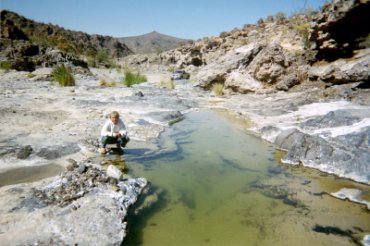
At the bottom of the long grade is Arroyo El Volcán (misnamed ‘Zamora’ in Almanac). We drove south (in the wash) 0.2 mi., then hiked. Beautiful pools here!
How Deep?
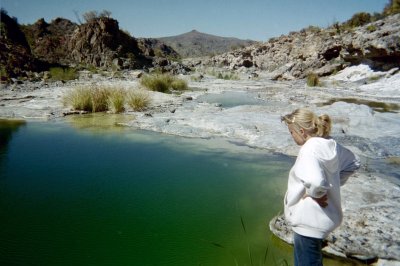
This pool seemed bottomless!
The El Volcán Onyx Dome 29°59.55′, -114°46.26′ (WGS84)
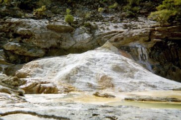
Growing out of the west side of the arroyo, this is the monthly geyser that gives El Volcán its name.
At the Top of the Dome
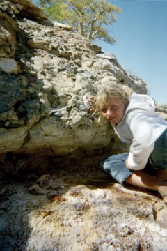
Here, I tell Sarah how fantastic it would be to get a photo of an eruption! She isn’t amused…
Looking North, Down the Arroyo
The onyx dome is on the left, my truck is 0.2 mile beyond, and the road from El Mármol is 0.4 mile from the dome. I hope you have enjoyed these photos as much as I enjoyed taking them! See other beautiful and exotic Baja locations at http://vivabaja.com/
My trips to Mission Santa María: